
Assessment of Geosite and Geomorphosite at South Solok Aspiring Geopark Area
DOI:
https://doi.org/10.25299/jgeet.2022.7.3.9520Keywords:
social media, local community, geodiversity, sustainabilityAbstract
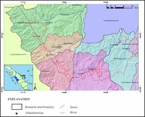
South Solok is one of the five districts designated as the aspiring of the Ranah Minang Geopark. Various reliefs and geological structures cause the diversity of landscapes to be an attraction for tourists and ecosystems with biodiversity. The study intends to identify geosite and geomorphosite in the South Solok area with field observations to describe the state of geology, geomorphology of geosite sites, and geomorphosite. Site assessment is carried out quantitatively with five assessment parameters; scientific, educational, functional, tourist, and posting activities on tourist sites on social media. Field observation found 17 sites classified into four groups, specifically waterfalls, manifestations of hot springs, geomorphological landscapes, and caves. Based on the results of the highest value representation obtained by the Batukapal Cave sites with a value of 44.86% and the lowest at Timbulun Waterfall at 0.1%. Of the 17 sites, four sites are considered the main sites in the research area: Suliti Waterfall, Sapan Maluluang Hot Spring Manifestation, Batukapal Cave, and Camintoran.
Downloads
References
Ansori, C., Warmada, I.W., Setiawan, N.I., Yogaswara, H., 2021. Geomorphosite Assessment at North Karangsambung -Karangbolong Geopark Kebumen, as Tools of Geotourism Development. J. Geosci. Eng. Environ. Technol. 6, 164–171.
Briggs, A., Newsome, D., Dowling, R., 2021. A proposed governance model for the adoption of geoparks in Australia. Int. J. Geoheritage Park. 1–13.
Brilha, J., 2016. Inventory and Quantitative Assessment of Geosites and Geodiversity Sites: a Review. Geoheritage 8, 119–134.
Darman, H., 2013. An outline of the geology of Indonesia. Geol. North Am. Overv. 233–264.
Gajek, G., Zgłobicki, W., Kołodyńska-Gawrysiak, R., 2019. Geoeducational Value of Quarries Located Within the Małopolska Vistula River Gap (E Poland). Geoheritage 11, 1335–1351.
Hausmann, A., Toivonen, T., Slotow, R., Tenkanen, H., Moilanen, A., Heikinheimo, V., Minin, E. Di, 2018. Social Media Data Can Be Used to Understand Tourists ’ Preferences for Nature-Based Experiences in Protected Areas 11, 1–10.
Hoang, T.P.C., Ha, Q.H., Nguyen, T.Q.N., 2021. Geomorphosites of Nui Chua National Park, Ninh Thuan Province, Vietnam. Int. J. Geoheritage Park. 9, 375–390.
Indonesia, J.G., 2019. Geopark solok selatan 2019.
Kubalíková, L., 2014. Geomorphosite assessment for geotourism purposes. Czech J. Tour. 2, 80–104.
Mihai IELENICZ, 2009. Geotope, Geosite, Geomorphosite. Ann. Valahia Univ. Târgovişte, Geogr. Ser. 9, 7–22.
Newsome, D., Dowling, R., 2018. Geoheritage and geotourism, Geoheritage: Assessment, Protection, and Management. Elsevier Inc.
Permanda, R., Putra, A., 2017. Estimasi Karakteristik Reservoir Panas Bumi dari Sumber Mata Air Panas di Kecamatan Pauh Duo, Kabupaten Solok Selatan. J. Fis. Unand 6, 39–46.
Presiden Republik Indonesia, 2019. Peraturan Presiden Nomor 9 Tahun 2019 tentang Pengembangan Taman Bumi.
Prosser, C.D., Díaz-Martínez, E., Larwood, J.G., 2018. The conservation of geosites: Principles and practice. Geoheritage Assessment, Prot. Manag. 193–212.
Reynard, E., 2005. Géomorphosites et paysages. Géomorphologie Reli. Process. Environ. 11, 181–188.
Reynard, E., Fontana, G., Kozlik, L., Pozza, C.S., 2007. Besinne: Une methode d’evaluation des valeurs scientifique et additionnelles des eeomorphosites. Geogr. Helv. 62, 148–158.
Reynard, E., Perret, A., Bussard, J., Grangier, L., Martin, S., 2016. Integrated Approach for the Inventory and Management of Geomorphological Heritage at the Regional Scale. Geoheritage 8, 43–60.
Rosidi, H.M.D, T., Pendowo, B., 1996. Geologic Map of the Painan and Northeastern of the Muara Siberut Quandrangle, Sumatera, GSI.
Sieh, K., Natawidjaja, D., 2000. Neotectonics of the Sumatran fault, Indonesia. J. Geophys. Res. Solid Earth 105, 28295–28326.
UNESCO, 2016. UNESCO Global Geoparks: Celebrating Earth Heritage, Sustaining Local Communities. UNESCO Program. Meet. Doc. 9–11.
Downloads
Published
Issue
Section
License
Copyright @2019. This is an open-access article distributed under the terms of the Creative Commons Attribution-ShareAlike 4.0 International License which permits unrestricted use, distribution, and reproduction in any medium. Copyrights of all materials published in JGEET are freely available without charge to users or / institution. Users are allowed to read, download, copy, distribute, search, or link to full-text articles in this journal without asking by giving appropriate credit, provide a link to the license, and indicate if changes were made. All of the remix, transform, or build upon the material must distribute the contributions under the same license as the original.


