
Analysis of Shoreline Shift using Satellite Imagery near Makassar City
DOI:
https://doi.org/10.25299/jgeet.2020.5.3.5111Keywords:
Makassar, Abrasion, Accretion, ShorelineAbstract
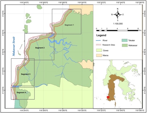
Shoreline shift have occurred in the Coastal region of Makassar City in recent years due to abrasion and accretion. Spatial temporal feature extraction of the Makassar City Region has been carried out using remote sensing techniques withRadiometri, Geometric Corrections and Composite Imagein the Landsat image dataset in 2009 and 2019. This study aims to analyze shoreline shift near Makassar City with remote sensing technology using Landsat imagery data, based on multi-temporal data with visual and digital analysis techniques between 2009 and 2019. This research contributes to local and central government as baseline data (data base) in making decisions for handling coastal areas. The results showed that the length of the Makassar City coastline without including the coastline length of the islands separated from land in a row that is equal to 37.79 km in 2009. While in 2019 there was a significant change that is 49.82 km. This shows the addition of a coastline of 12.03 km in the span of 10 years. These changes are mainly caused by anthropogenic factors, namely the construction of the pier / port and the reclamation and hydro-oceanographic factors, namely waves, currents and tides.
Downloads
References
Agus, I Made, Wirahadi Putra, Adhi Susanto, And Indah Soesanti. 2015. “Ekstraksi Garis Pantai Pada Citra Satelit Landsat Dengan Metode Segmentasi Dan Deteksi Tepi.” Jurnal Nasional Pendidikan Teknik Informatika (Janapati) 4(3): 115–20.
Angkotasan, Abdul Motalib, I Wayan Nurjaya, And Nyoman M N Natih. 2012. “Analisis Perubahan Garis Pantai Di Pantai Barat Daya Pulau Ternate , Provinsi Maluku Utara ( Shoreline Change Analysis Of The South West Coast At Ternate Island , North Molucas Province ).” Jurnal Teknologi Perikanan Dan Kelautan 3(2): 11–22.
Aryastana, Putu, I Gusti Agung Putu Eryani, And Kadek Windy Candrayana. 2015. “Perubahan Garis Pantai Dengan Citra Satelit Di Kabupaten Gianyar.” Paduraksa 5(2): 70–81.Fan, Yaoshen Et Al. 2017. “Shoreline Dynamics Of The Active Yellow River Delta Since The Implementation Of Water-Sediment Regulation Scheme : A Remote-Sensing And Statistics-Based Approach.”
Kulmawapa. A. R., Afu. A. O. L., Takwir. A. 2017. Studi Perubahan Garis Pantai Dengan Pendekatan Penginderaan Jauh Di Wilayah Pesisir Kecamatan Mawasangka Kabupaten Buton Tengah. Diakses Pada Tanggal: 17 Juli 2019.
Suwandana, Endan. 2019. “Depik.” Depik, Jurnal Ilmu-Ilmu Perairan, Pesisir Dan Perikanan 8(3): 193–206.
Syukhriani, Silvy, Eko Nofridiansyah, And Bambang Sulistyo. 2017. “Analisis Data Citra Landsat Untuk Pemantauan Perubahan Garis Pantai Kota Bengkulu.” Jurnal Enggano 2(1): 90–100.
Wicaksono, Arief, And Pramaditya Wicaksono. 2019. “Akurasi Geometri Garis Pantai Hasil Transformasi Indeks Air Pada Berbagai Penutup Lahan Di Kabupaten Jepara.” Majalah Geografi Indonesia 33(1): 86–94.
Tejakusuma I. G. 2011. Pengkajian Kerentanan Fisik Untuk Pengembangan Pesisir Wilayah Kota Makassar. Jurnal Sains Dan Teknologi Indonesia. 13(2) : 82-87.
Yulius M., Dan Ramdhan. 2013. Perubahan Garis Pantai Di Teluk Bungus Kota Padang Provinsi Sumatra Barat Berdasarkan Analisis Citra Satelit. Jurnal Ilmu Dan Teknologi Kelautan Tropis. 5(2) : 417-427.
Downloads
Published
Issue
Section
License
Copyright @2019. This is an open-access article distributed under the terms of the Creative Commons Attribution-ShareAlike 4.0 International License which permits unrestricted use, distribution, and reproduction in any medium. Copyrights of all materials published in JGEET are freely available without charge to users or / institution. Users are allowed to read, download, copy, distribute, search, or link to full-text articles in this journal without asking by giving appropriate credit, provide a link to the license, and indicate if changes were made. All of the remix, transform, or build upon the material must distribute the contributions under the same license as the original.


