
Determination of Priority Regions as The Direction of Decision-Making for Land Development of West Kalimantan Province
DOI:
https://doi.org/10.25299/jgeet.2019.4.3.2908Keywords:
Land Development, Priority Region, Economic Land Productivity.Abstract
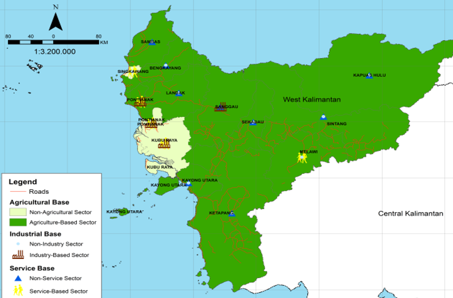
Indonesia is an archipelago country consisting of large and small islands with a large number of approximately 17,508. Some of the islands are among the border to neighboring countries. One of the islands is a border area of land that is found on the island of Borneo, especially West Kalimantan Province. West Kalimantan province is directly adjacent to Malaysia. The identic character of the Indonesian border area is largely a lagging region. Determination of priority areas is certainly needed as an effective way of developing these border areas. The objectives of the research include (1) identification of the distribution of lagging priority areas in West Kalimantan Province, (2) give recommendations related to development of lagging priority areas. Overlays of lagging region parameters and economic productivity are used to determine priority areas. The result of identification is known that Bengkayang Regency, Kayong Utara, and Melawi are the lagging priority areas. Recommendation given to the lagging priority regions are through regional development model and also based on determination of base sector.
Downloads
References
Dinas Kesehatan. 2011. Profil Kesehatan Kabupaten Kayong Utara Tahun 2010. Dinas Kesehatan: Sukadana.
Drobne, S. and Lisec,A. 2009. Multi-attribute Decision Analysis in GIS: Weighted Linear Combination and Ordered Weighted Averaging: Informatica.
Giyarsih, S.R. (2017). Regional Management of Areas with Indications of Urban Sprawl in the Surrounding Areas of Universitas Muhamadiyah Yogyakarta, Indonesia. Indonesian Journal of Geography 49 (1), : 35-41.
Kementrian Negara Pembangunan Daerah Tertinggal. 2005. Strategi Nasional Percepatan Pembangunan Daerah Tertinggal. Jakarta : KPDT.
S Khondker, Bazlul H. and MoogdhoMim M. 2015. Underdeveloped Districts Development: Background Study Paper for Preparation of the Seventh Five-Year Plan.
Kiggundu, A.T. 2014.Constraints to Urban Planning and Management of Secondary Towns in Uganda. International Journal Of Geography 46 (1):(12 - 21).
Muta’ali, Luthfi. 2015 (a). Pengembangan Kawasan Perbatasan. Yogyakarta: Badan Penerbit Fakultas Geografi UGM.
Muta’ali, Luthfi. 2015 (b). Teknik Analisis Regional Untuk Perencanaan Wilayah, Tata Ruang, dan Lingkungan. Yogyakarta: Badan Penerbit Fakultas Geografi UGM.
Okysari, H. Muta’ali, L. 2015. Pengembangan Wilayah Tertinggal Di Kabupaten Klaten. Yogyakarta: Fakultas Geografi.
PPSP. 2013. Buku Putih Sanitasi Kabupaten Kayong Utara. Available in: https://ppsp.nawasis. Accessed in 18 January 2019.
PPSP. 2013. Profil Sanitasi Kabupaten Melawi. Available in: http://ppsp.nawasis.info/dokumen/perencanaan/sanitasi/
pokja/ssk/revisi/Kab.%20Melawi/Bab%20II%20SSK%
20new1%20sdh%20di%20QA.pdf. Accessed in 22 February 2019.
Putri, R.F., Bayuaji, L., Sumantyo, J.T.S., and Kuze, H. 2013. TerraSAR-X DInSAR for land deformation detection in Jakarta Urban area, Indonesia. Journal of Urban and Environmental Engineering. Vol 7(2), pp. 195-205. Doi: 10.4090/juee.2013.v7n2.195205.
Tarigan, R. 2005. Perencanaan Pembangunan Wilayah. Bumi Aksara: Jakarta.
Tarigan, R. 2009. Ekonomi Regional Teori Dan Aplikasi. PT. Bumi Aksara, Jakarta.
Taena, Werenfridus. 2009. Kajian Pengembangan Ekonomi Wilayah Perbatasan Kabupaten Timor Tengah Utara dengan Distrik Enclave Oekusi. Thesis. Graduate School Program. Institut Pertanian Bogor.
Downloads
Published
Issue
Section
License
Copyright @2019. This is an open-access article distributed under the terms of the Creative Commons Attribution-ShareAlike 4.0 International License which permits unrestricted use, distribution, and reproduction in any medium. Copyrights of all materials published in JGEET are freely available without charge to users or / institution. Users are allowed to read, download, copy, distribute, search, or link to full-text articles in this journal without asking by giving appropriate credit, provide a link to the license, and indicate if changes were made. All of the remix, transform, or build upon the material must distribute the contributions under the same license as the original.


