Multi-Criteria Geological Assessment for Geosite Prioritization in the Alteration Zone of Bogor Halimun Salak Geopark, West Java, Indonesia
Keywords:
Geosite prioritization, Hydrothermal Alteration, Geological Carrying capacity, Bogor Halimun Salak GeoparkAbstract
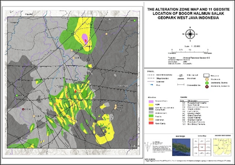
The sustainable development and conservation of geosites require an assessment that distinguishes geoheritage value from the physical capacity of land to support safe use. This study evaluates ten geosites in the hydrothermal alteration zone of the Bogor Halimun Salak Geopark, West Java, Indonesia, using an integrated multi-criteria geological framework. The Geological Agency scheme was modified by exchanging the weights assigned to groundwater availability (14 to 2) and soil-rock bearing capacity (2 to 14), while retaining the total supporting-factor weight. This modification was adopted because the original output was dominated by the hydrogeological pattern, whereas engineering suitability in clay-rich alteration zones is more directly controlled by material strength and stability. GIS overlay, laboratory-derived engineering-geology information, and field verification were used to integrate lithology, slope, bearing capacity, aquifer productivity, landslide susceptibility, and land-use constraints. The modified scheme expanded the high-suitability area from 2,673.88 to 5,898.13 ha, reduced the moderate class from 9,802.93 to 5,552.50 ha, and increased the low class to 2,985.28 ha, thereby improving spatial discrimination. Two geosites were classified as high suitability, two as moderate suitability, and six as low suitability. High-suitability sites are generally associated with competent volcanic rocks, gentle slopes, and relatively high bearing capacity, whereas low-suitability sites commonly occur in clay-rich altered materials with high plasticity, shrink-swell behaviour, and landslide constraints. The framework supports decision-making by separating locations suitable for controlled facilities from sites requiring restricted development and conservation-oriented management.
Downloads
References
Ansori, C. et al. (2021) “Geomorphosite Assessment at North Karangsambung -Karangbolong Geopark Kebumen, as Tools of Geotourism Development,” Journal of Geoscience, Engineering, Environment, and Technology, 6(3), pp. 164–171.
Ansori, C. et al. (2024) “The linkage of geological parameters to cultural diversity at Karangsambung-Karangbolong Geopark and surrounding area, Kebumen, Indonesia,” International Journal of Geoheritage and Parks, 12(1), pp. 168–179.
Bakosurtanal (2000) “1209-131,” p. 1.
Bogor Regency Regional Disaster Management Agency (BPBD) (2020) Disaster event metadata of Bogor Regency, 2020.
Bogor Regency Statistics Agency (BPS) (2024) Bogor Regency in figures 2024. Bogor.
Canesin, T.S., Brilha, J. and Díaz-Martínez, E. (2020) “Best Practices and Constraints in Geopark Management: Comparative Analysis of Two Spanish UNESCO Global Geoparks,” Geoheritage, 12(1), p. 14.
Center for Volcanology and Geological Hazard Mitigation (PVMBG) (no date) Ministry of Energy and Mineral Resources. Available at: Landslide susceptibility zones.
Daryono (2006) “River density classification and watershed morphometric characteristics. Agency for the Assessment and Application of Technology.”
Directorate General of Mineral and Coal (Minerba) (2012) “Menyusuri Jejak Gurandil di Tambang Emas Pongkor,”
Duarte, A. et al. (2020) “Geotourism and Territorial Development: a Systematic Literature Review and Research Agenda,” Geoheritage, 12(3), p. 65.
Effendi, A.C., Kusnama, H.B. and Hermanto, B. (1998) “Geological Map of The Bogor Quadrangle, Java,” Volcanological Survey of Indonesia [Preprint].
Fadlin et al. (2020) “Geodiversity of Menganti Paleo-Volcano: New Insight to Geotourism Potential in Kebumen, Central Java, Indonesia,” Journal of Geoscience, Engineering, Environment, and Technology, 5(1), pp. 11–24.
Ferdowsi, S. and Németh, K. (2026) “Geoparks Management in Tourism Destinations: Integrating Development and Conservation,” Sustainable Development, 34(S2), pp. 1034–1056.
Geological Agency (no date) “ Land suitability map based on geological aspects of the Greater Jakarta–Bogor–Depok–Tangerang–Bekasi–Puncak–Cianjur (Jabodetabek-Punjur) area.” Ministry of Energy and Mineral Resources.
Geospatial Information Agency (BIG), Meteorological, C. and G.A. (BMKG) and Directorate General of Water Resources, 2017 (2017) “Flood hazard map of Bogor Regency. 1st ed. Scale 1:50,000.” Bogor, pp. 1–1.
Gevor, E., Indrawan, I.G.B. and Warmada, I.W. (2024) “Geological Investigation of Clay Minerals (Swelling) Pt. Upb Antam Pongkor Bogor, West Java, Indoneisa,” Journal of Applied Geology, 9(1), p. 51.
Ginanjar, R. and Sadisun, I.A. (2019) “KARAKTERISTIK GEOTEKNIK MINERAL LEMPUNG PADA TEROWONGAN TAMBANG BAWAH TANAH CIURUG LEVEL 600, PONGKOR, JAWA BARAT,” Bulletin of Geology, 3(1), pp. 328–332.
Government of Bogor Regency (2024a) Decree of the Regent of Bogor No. 000.9/207/Kpts/Per-UU/2024 on the designation of the change of name of the Pongkor National Geopark Area to the Bogor Halimun Salak National Geopark Area, Government of Bogor Regency.
Government of Bogor Regency (2024b) Map appendix of Regional Regulation of Bogor Regency No. 1 of 2024 concerning the regional spatial plan (RTRW) 2024–2044, Government of Bogor Regency.
Government of Bogor Regency (2024c) Regional Regulation of Bogor Regency No. 1 of 2024 concerning the Regional Spatial Plan of Bogor Regency for 2024–2044, Government of Bogor Regency.
Government of Indonesia (1990) “Presidential Decree of the Republic of Indonesia No. 32 of 1990 on the management of protected areas. .” Jakarta: Government of Indonesia.
Guju, D.-I., Luca, G.-G. and Comănescu, L. (2025) “Geotourism: A Landscape Conservation Approach in Țara Hațegului, Romania,” Land, 14(6), p. 1298.
Haerani, N. et al. (2003) “Map of disaster-prone areas of Salak Volcano, West Java Province. Scale 1:50,000.” Center for Volcanology and Geological Hazard Mitigation.
Haryanto, A.D. et al. (2015) “ALTERATION, ORE MINERALOGY, AND FLUID INCLUSION MICROTHERMOMETRY OF THE RORAH KADAL QUARTZ VEIN IN CIBALIUNG GOLDFIELD, WESTERN JAVA, INDONESIA,” ASEAN Engineering Journal, 4(2), pp. 53–67.
Hilmi, F. and Haryanto, I. (2008) “Regional structural patterns of West Java,” Bulletin of Scientific Contribution, 6(1), pp. 57–66.
Idris, M. V., Muksin, U. and Syukri, M. (2024) “The Influence of Slope, Rock Characteristics and Meteorological Data to Landslide: A Case Study in The Northernmost Sumatra, Indonesia,” Journal of Geoscience, Engineering, Environment, and Technology, 9(04), pp. 511–518.
Ishwaran, N., Persic, A. and Tri, N.H. (2008) “Concept and practice: the case of UNESCO biosphere reserves,” International Journal of Environment and Sustainable Development, 7(2), p. 118.
Joyce, E.B. (2010) “Australia’s Geoheritage: History of Study, A New Inventory of Geosites and Applications to Geotourism and Geoparks,” Geoheritage, 2(1–2), pp. 39–56.
Komine, H. and Ogata, N. (2003) “New equations for swelling characteristics of bentonite-based buffer materials,” Canadian Geotechnical Journal, 40(2), pp. 460–475.
Martínez-Murillo, J.F., Menjíbar-Romero, M. and Remond, R. (2025) “Assessment of the visual fragility of geomorphological landscapes and geodiversity sites in the Sierras Subbéticas UNESCO Global Geopark (southern Spain),” Geomorphology, 488, p. 109971.
Milesi, J.P. et al. (1994) “Cirotan, West Java, Indonesia; a 1.7 Ma hybrid epithermal Au-Ag-Sn-W deposit,” Economic Geology, 89(2), pp. 227–245.
Milési, J.P. et al. (1999) “Pongkor (west Java, Indonesia): a Pliocene supergene-enriched epithermal Au-Ag-(Mn) deposit,” Mineralium Deposita, 34(2), pp. 131–149.
Ministry of Agrarian Affairs and Spatial Planning/National Land Agency (ATR/BPN) (2025) SKALA GISLINER: Protected paddy field mapping, gisliner.
Murtianto, E. (no date) “Hydrogeological map of the Bogor Sheet. Scale 1:100,000. Geological Agency, Ministry of Energy and Mineral Resources.” Bandung: Geological Agency, Ministry of Energy and Mineral Resources., p. 1.
Peña, L. et al. (2017) “A Holistic Approach Including Biological and Geological Criteria for Integrative Management in Protected Areas,” Environmental Management, 59(2), pp. 325–337.
Pérez-Romero, M.E. et al. (2023) “UNESCO Global Geoparks 22 Years after Their Creation: Analysis of Scientific Production,” Land, 12(3), p. 671.
PT ANTAM Tbk Geomin Unit (2023) “lteration map. Unpublished repor.” Indonesia.
Putro, R.. (2019) “Geology and the influence of alteration on landslide potential in Citorek Kidul, Lebak Regency, Banten Province,” 6(1), pp. 51–64.
ROHAENDI, N. et al. (2021) “GEO-TOURISM LAND SUITABILITY ANALYSIS OF CITATAH KARST AREA IN BANDUNG BASIN USING SPATIAL MULTI CRITERIA EVALUATION (SMCE),” GeoJournal of Tourism and Geosites, 39(4 supplement), pp. 1346–1353.
Rosana, M.F. and Matsueda, H. (2002) “Cikidang Hydrothermal Gold Deposit in Western Java, Indonesia,” Resource Geology, 52(4), pp. 341–352.
Ruban, D.A., Sallam, E.S. and Wanas, H.A. (2019) “Middle–Late Jurassic sedimentation and sea-level changes on the northeast African margin: A case study in the Khashm El-Galala area, NE Egypt,” Journal of African Earth Sciences, 156, pp. 189–202.
Sahara, R. and Setiawan, B. (2022) “Assessment of Geosite and Geomorphosite at South Solok Aspiring Geopark Area,” Journal of Geoscience, Engineering, Environment, and Technology, 7(3), pp. 110–116.
Silwal, B.R., Ota, K. and Yoshida, K. (2024) “Effects of hydrothermal activity and weathering in the active fault area: formation of large landslide and landslide dam lake, Lake Nakatsuna, Nagano, Japan,” Natural Hazards, 120(9), pp. 9057–9091.
Sumaryono (2022) “Shapefile map of landslide susceptibility zones in Bogor Regency/City. GIS shapefile.,” Center for Volcanology and Geological Hazard Mitigation (PVMBG). [Preprint].
T. Tobing and Lutfhi, A. (1996) “Engineering geological map of the Bogor Quadrangle, West Java. Scale 1:100,000.” Geological Agency, Ministry of Energy and Mineral Resources, Indonesia.
UNESCO (1996) “Biosphere reserves: The Seville Strategy and the statutory framework of the World Network.,”
UNESCO (2021) UNESCO Global Geoparks (UGGp).
VERDUGO, C. et al. (2025) “A SUSTAINABILITY MODEL OF GEOPARKS APPLIED TO THE TUNGURAHUA VOLCANO GEOPARK,” Geojournal of Tourism and Geosites, 61(3), pp. 1719–1729.
Wibowo, D.A. et al. (2024) “Assessment of Physical, Social, and Economic Vulnerability to Landslides Disaster in the Karangsambung Karangbolong National Geopark, Indonesia.,” IOP Conference Series: Earth and Environmental Science, 1378(1), p. 012003.
Widawski, K. et al. (2018) “Attractiveness of protected areas for geotourism purposes from the perspective of visitors: the example of Babiogórski National Park (Poland),” Open Geosciences, 10(1), pp. 358–366.
Yusuf, N.J. et al. (2023) “Study of Boalemo Red Limestone for Geotourism Development based on Lithological, Geochemical Analysis and Geological Heritage Assessment,” Journal of Geoscience, Engineering, Environment, and Technology, 8(3), pp. 212–220.
Zouros, N.C. (2010) “Lesvos Petrified Forest Geopark, Greece: Geoconservation, Geotourism, and Local Development,” The George Wright Forum, 27(1), pp. 19–28.
Downloads
Published
Issue
Section
License
Copyright (c) 2026 Journal of Geoscience, Engineering, Environment, and Technology

This work is licensed under a Creative Commons Attribution-ShareAlike 4.0 International License.
Copyright @2019. This is an open-access article distributed under the terms of the Creative Commons Attribution-ShareAlike 4.0 International License which permits unrestricted use, distribution, and reproduction in any medium. Copyrights of all materials published in JGEET are freely available without charge to users or / institution. Users are allowed to read, download, copy, distribute, search, or link to full-text articles in this journal without asking by giving appropriate credit, provide a link to the license, and indicate if changes were made. All of the remix, transform, or build upon the material must distribute the contributions under the same license as the original.