
The Utilization of LiCSBAS for Deformation Monitoring in Geresa Segment of Matano Fault, Central Sulawesi, Indonesia
DOI:
https://doi.org/10.25299/jgeet.2024.9.1.14212Keywords:
Geresa Segment, Matano Fault, Deformation, LiCSBASAbstract
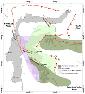
Sulawesi is situated between the confluence of three plates, resulting in a very complex tectonic setting on the island. This has an impact on the occurrence of geological structures, including faults. One of them is the Matano Fault which consists of 6 segments (Kuleana Segment, Pewusai Segment, Matano Segment, Pamsoa Segment, Ballawai Segment, and Geresa Segment). The research area is located in Morowali Regency, covering the Geresa Segment. Morowali Regency recorded an earthquake with a magnitude of 5.7 in 2012. This indicates that deformation has occurred. Therefore, this study aims to identify the deformation velocity around the Geresa Segment area. The methods used are geological observation and satellite image data processing to obtain information on deformation rates. The geological field study includes aspects of geomorphology, geological structure, and the rock types distribution. Meanwhile, the processing of satellite image data in the form of InSAR is carried out through the LiCSBAS package tools that has been integrated with LiCSAR. The analysis results illustrate the difference in deformation velocity around the Geresa Segment area. The area which is composed of Tolaka formation and Ultramafic complex tends to uplift with a deformation rate of up to 17 mm/year. In addition, alluvium that covers the southeastarn part has a land subsidence of up to 7 mm/year.
Downloads
References
Afifuddin, et al., 2022. The Strategy of GNSS CORS Processing in Southern Sumatera. 2022 IEEE Asia-Pacific Conference on Geoscience, Electronics and Remote Sensing Technology (AGERS), 17-23.
Al Ghiffari, M.R., et al., 2022. Optimization of Loop Closure Phase on LiCSBAS for Ground Deformation Monitoring in Southern Sumatra. 2022 IEEE Asia-Pacific Conference on Geoscience, Electronics and Remote Sensing Technology (AGERS), 6-12.
Dewanto, B.G., Setiawan, M.B., Nusantara, G.C., 2020. Opak Fault Deformation Monitoring Using Sentinel-1 InSAR Data from 2016-2019 in Yogyakarta Indonesia. Elipsoida: Jurnal Geodesi dan Geomatika 3, 46-54.
Ghorbani, Z., et al., 2022. Use of InSAR data for measuring land subsidence induced by groundwater withdrawal and climate change in Ardabil Plain, Iran. Scientific Reports 12.
Jefriza, et al., 2020. The applications of InSAR technique for natural hazard detection in smart society. Journal of Physics: Conference Series 1572,
Kriswati, E., et al., 2021. Long Term Ground Deformation of Mount Raung as Inferred by InSAR and GPS Data. 2021 7th Asia-Pacific Conference on Synthetic Aperture Radar (APSAR), 1-4.
Kurniawati, I., Ratri, A.D.P., Gunawan, T., 2020. Karakteristik Gempabumi di Sesar Matano Menggunakan Analisis Energi Kumulatif dan Periode Ulang. Jurnal Geocelebes 4, 33-40.
Lazecký, M., et al., 2020. LiCSAR: An automatic InSAR tool for measuring and monitoring tectonic and volcanic activity. Remote Sensing 12.
Morishita, Y., et al., 2020. LiCSBAS: An open-source InSAR time series analysis package integrated with the LiCSAR automated Sentinel-1 InSAR processor. Remote Sensing 12.
Nugroho, D., et al., 2022. Estimation of Ground Deformation in Southern Sumatra Using InSAR and GNSS Data Processing. Journal of Engineering Science and Technology Special Issue on AASEC2022, 85-90,
Panggabean H., Surono, 2011. Tektono-Stratigrafi Bagian Timur Sulawesi. Jurnal Sumber Daya Geologi 21, 239-248.
Pepe, A., Calo, F., 2017. A Review of Interferometric Synthetic Aperture RADAR (InSAR) Multi-Track Approaches for the Retrieval of Earth’s Surface Displacements. Applied Science 7.
Pertiwi, I.I., 2022. Analisis Statistik Distribusi Kejadian Gempabumi Di Luwu Timur, Morowali, Dan Morowali Utara, Sulawesi. Jurnal Geofisika 20, 1-7.
Pusat Studi Gempa Nasional (PUSGEN), 2017. Peta Sumber dan Bahaya Gempa Indonesia Tahun 2017. Badan Penelitian dan Pengembangan Kementerian Pekerjaan Umum dan Perumahan Rakyat.
Rosyidy, M., et al., 2021. Landslide Surface Deformation Analysis Using Sbas-Insar In The Southern Part Of The Sukabumi Area, Indonesia. Geographia Technica 16, 138-152.
Sarsito, D.A., 2010. Pemodelan Geometrik dan Kinematik Kawasan Sulawesi dan Kalimantan Bagian Timur Berdasarkan Data GNSS-GPS dan Gaya Berat Global (dissertation).
Simandjuntak, T.O., Rusmana, E., Supandjono, J.B., Koswara, A., 1993. Peta Geologi Lembang Bungku, Sulawesi. Pusat Penelitian dan Pengembangan Geologi.
Ulin, R.F., Taufik, M., Anjasmara, I. M., 2019. Application of PSInSAR Method for the Land Subsidence Analysis Using StaMPS (Case Study : Gresik Regency). IPTEK Journal of Proceeding Series 2, 57-59,
Wang, Q., Yu, W., Xu, B., Wei, G., 2019. Assessing the use of GACOS products for SBAS-INSAR deformation monitoring: A case in Southern California. Sensors 19.
Zhou, X., Chang, N.B., Li, S., 2009. Applications of SAR Interferometry in Earth and Environmental Science Research. Sensors 9.
Downloads
Published
Issue
Section
License
Copyright (c) 2024 Journal of Geoscience, Engineering, Environment, and Technology

This work is licensed under a Creative Commons Attribution-ShareAlike 4.0 International License.
Copyright @2019. This is an open-access article distributed under the terms of the Creative Commons Attribution-ShareAlike 4.0 International License which permits unrestricted use, distribution, and reproduction in any medium. Copyrights of all materials published in JGEET are freely available without charge to users or / institution. Users are allowed to read, download, copy, distribute, search, or link to full-text articles in this journal without asking by giving appropriate credit, provide a link to the license, and indicate if changes were made. All of the remix, transform, or build upon the material must distribute the contributions under the same license as the original.


