
Analysis Of Presumed Land Subsidence In The Cities Of Lampung Province Using InSAR And GNSS Data
DOI:
https://doi.org/10.25299/jgeet.2024.9.3.14096Keywords:
Cities, GNSS, Land Subsidence, InSAR, SBAS, Sentinel-1AAbstract
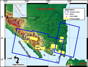
Land subsidence is a naturally occurring phenomenon that has become a growing concern in various regions, including Lampung Province. In this study, we investigate land subsidence in various cities within Lampung Province, Indonesia, utilizing Sentinel-1A using Sentinel-1A satellite image data from the period 2014 to 2022. The cities of Lampung Province analyzed in this study were Liwa, Kota Agung, Kalianda, Sukadana, Bandar Lampung and Krui. The method used is Interferometric Synthetic Aperture Radar (InSAR) with the Small Baseline Area Subset (SBAS) technique. Furthermore, to validate and improve the accuracy of land subsidence measurements, the Global Navigation Satellite System (GNSS) velocities were utilized. The land subsidence result obtained in this study is presumed land subsidence. The cities that experienced land subsidence was Kalianda, Sukadana, Bandar Lampung and Krui ranging from ~3 mm/yr to ~15 mm/yr. Meanwhile, the areas that experienced an uplift were the Liwa and Kota Agung cities.
Downloads
References
Abidin, H. Z., Andreas, H., Gumilar, I., Sidiq, T. P., & Fukuda, Y. (2013). Land subsidence in coastal city of Semarang (Indonesia): characteristics, impacts and causes. Geomatics, Natural Hazards and Risk, 4(3), 226-240.
Alif, S. M., Fattah, E. I. & Kholil, M., (2020). Geodetic slip rate and locking depth of east Semangko Fault derived from GPS measurement. Geodesi dan Geodinamika, pp. 222-228.
Alif, S. M., (2022). Slip Rate of Kumering Fault in Lampung Province Calculated from GPS Data from 2007 to 2021. Jurnal Geosains dan Teknologi, 5(2), pp. 83-90.
Anggara, O., Welly, T. K., Fauzi, A. I., Alif, S. M., Perdana, R. S., Oktarina, S. W., Nuha, M. N., & Rosadi, U. (2023). Monitoring ground deformation of Sinabung volcano eruption 2018-2019 using DInSAR technique and GPS data. In AIP Conference Proceedings (Vol. 2654, No. 1). AIP Publishing.
Ardha, M., Argo, G. S., Julzarika, A., Yulianto, F., Yudhatama, D., & Rofifatuz, Z. D. (2021). Utilization of Sentinel-1 satellite imagery data to support land subsidence analysis in DKI Jakarta, Indonesia. Journal of Degraded and Mining Lands Management, 8(2), 2587-2593.
Bott, L. M., Schöne, T., Illigner, J., Haghighi, M. H., Gisevius, K., & Braun, B. (2021). Land subsidence in Jakarta and Semarang Bay–The relationship between physical processes, risk perception, and household adaptation. Ocean & Coastal Management, 211, 105775.
Cigna, F., & Tapete, D. (2021). Present-day land subsidence rates, surface faulting hazard and risk in Mexico City with 2014–2020 Sentinel-1 IW InSAR. Remote Sensing of Environment, 253, 112161.
Cigna, F., & Tapete, D. (2022). Urban growth and land subsidence: Multi-decadal investigation using human settlement data and satellite InSAR in Morelia, Mexico. Science of The Total Environment, 811, 152211.
Endo, T., (2011). Sinking Cities and Governmental Action: Institutional Responses to Land Subsidence in Osaka and Bangkok. Groundwater and Subsurface Environments.
Farr, Tom G., “The Shuttle Radar Topography Mission.” AGU Advances, vol. 45, no. 2, 2007.
Ghorbani, Z., Khosravi, A., Maghsoudi, Y., Mojtahedi, F. F., Javadnia, E., & Nazari, A. (2022). Use of InSAR data for measuring land subsidence induced by groundwater withdrawal and climate change in Ardabil Plain, Iran. Scientific Reports, 12(1), 13998.
Gumilar, I., Sidiq, T. P., Virtriana, R., Pambudi, G., Bramanto, B., & Abidin, H. Z. (2023). Geodetic observations confirming land subsidence of Bandung Basin, Indonesia, and subsequent building damage. Acta Geodaetica et Geophysica, 1-16.
Hakim, W. L., Achmad, A. R., & Lee, C. W. (2020). Land subsidence susceptibility mapping in jakarta using functional and meta-ensemble machine learning algorithm based on time-series InSAR data. Remote Sensing, 12(21), 3627.
Hayati, N., Widodo, A., Kurniawan, A., Sanjiwani, I. D. M. A., Darminto, M. R., Yudha, I. S., & Sumantyo, J. T. S. (2022). Small baselines techniques of time series InSAR to monitor and predict land subsidence causing flood vulnerability in Sidoarjo, Indonesia. Geomatics, Natural Hazards and Risk, 13(1), 2124-2150.
Hestiningsih, (2021). Pemetaan Zona Penurunan Tanah (Land Subsidence) dengan Menggunakan Metode Penginderaan Jauh. pp. 1-105.
Hu, B., (2009). Risk assessment of land subsidence at Tianjin coastal area in China. Environmental Earth Sciences, pp. 269-276.
Luo, Q., Li, J., & Zhang, Y. (2022). Monitoring Subsidence over the Planned Jakarta–Bandung (Indonesia) High-Speed Railway Using Sentinel-1 Multi-Temporal InSAR Data. Remote Sensing, 14(17), 4138.
Perkim Provinsi Lampung, (2020). Permukiman, Perumahan dan Kawasan. [Online] Available at: https://perkim.id/profil-pkp/profil-provinsi/profil-perumahan-dan-kawasan-permukiman-provinsi-lampung/[Accessed 19 April 2023].
SIMREG, B., (2022). SIMREG Sistem Informasi dan Manajemen Data Dasar Regional. [Online]Available at: https://simreg.bappenas.go.id/[Accessed 14 Desember 2022].
Sosilawati, (2017). Sinkronisasi Program dan Pembiayaan Pembangunan Jangka Pendek 2018-2020 Keterpaduan Pengembangan Kawasan dengan Infrastruktur PUPR Pulau Sumatera. Jakarta: Pusat Pemrograman dan Evaluasi Keterpaduan Infrastruktur PUPR.
Yalvac, S. (2020). Validating InSAR-SBAS results by means of different GNSS analysis techniques in medium-and high-grade deformation areas. Environmental monitoring and assessment, 192(2), 120.
Yulyta, S. A., (2018). Aplikasi Metode SBAS-DInSAR Menggunakan Data Sentinel-1A Untuk Pengamatan Penurunan Muka Tanah Di Kota Surabaya. pp. 1-97.
Downloads
Published
Issue
Section
License
Copyright (c) 2024 Journal of Geoscience, Engineering, Environment, and Technology

This work is licensed under a Creative Commons Attribution-ShareAlike 4.0 International License.
Copyright @2019. This is an open-access article distributed under the terms of the Creative Commons Attribution-ShareAlike 4.0 International License which permits unrestricted use, distribution, and reproduction in any medium. Copyrights of all materials published in JGEET are freely available without charge to users or / institution. Users are allowed to read, download, copy, distribute, search, or link to full-text articles in this journal without asking by giving appropriate credit, provide a link to the license, and indicate if changes were made. All of the remix, transform, or build upon the material must distribute the contributions under the same license as the original.


