
Identification of Deep Groundwater Aquifer Zones with Geoelectrical Method in Sukadanaham Area Bandar Lampung, Indonesia
DOI:
https://doi.org/10.25299/jgeet.2024.9.1.13948Keywords:
Geoelectrical, Resistivity, Aquifer, LithologyAbstract
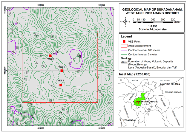
Research on groundwater aquifers using the geoelectric method has been carried out in the Sukadanaham area, Tanjung Karang Barat District, Bandar Lampung City. This Research Objectives This research aims to identify the lithology and depth of groundwater aquifer zones based on resistivity values and geological literature. Data acquisition was carried out using the Schlumberger configuration of 3 points in the young Betung volcanic formation (Qhvb). The data used is the resistivity value. Resistivity value data is modeled vertically with inverted results. The resistivity value of each point is adjusted and interpolated based on the literature on rock resistivity values. Based on the identification results, 4 types of subsurface rock lithology were found, namely top soil, tuff, breccia, and andesite. The lithology of the layers at point 1, point 2 and point 3 is dominated by tuff and breccia layers. The resistivity value of the andesite layer obtained has a high value, which is > 300 Ωm. The resistivity value of the tuff layer for the waterproof layer has a value of 200-250 Ωm. The breccia layer acts as a groundwater aquifer zone with a low resistivity value of 15-60 Ωm. The rock resistivity value with the lowest value is at a depth of 40-95 m which is a compressed aquifer layer with andesite and tuff layers as a waterproof layer above and below.
Downloads
References
Antosia, R. M., Ramdan, M., 2023. A combined method of 1D and 2D resistivity for groundwater layer estimation at a farming area in Rejomulyo Village. Spektra: Jurnal Fisika dan Aplikasinya, 8(1).
Arowoogun, K. I., Osinowo, O. O., 2022. 3D resistivity model of 1D vertical electrical sounding (VES) data for groundwater potential and aquifer protective capacity assessment: A case study. Modeling Earth Systems and Environment, 8(2), 2615-2626.
Asmaranto, R., 2012. Hidrogeologi Identifikasi Air Tanah (Groundwater) Menggunakan Metode Resistivity (Geolistrik with IP2Win Software). Malang. Universitas Brawijaya.
Badan Pusat Statistik Kota Bandar Lampung, 2022. Kecamatan Tanjung Karang Barat Dalam Angka Tanjung Karang Barat Subdistrict in Figures 2022. Bandar Lampung. BPS-Statistics of Bandar Lampung Municipality.
Falae, P. H., Kanungo, D. P., Chauhan, P. K. S., Dash, R. K., 2019. Electrical Resistivity Tomography (ERT) Based Subsurface Characterisation of Pakhi Landslide, Garhwal Himalayas, India. Environmental Earth Sciences, 78(14), 1-18.
Haerudin, N., Rustadi., Marjunus, R., Zaenudin, A., Kurniasih, A., Ferucha, I., 2022. 2D Modelling Gravity Methods For Mapping Subsurface Basin of Bandar Lampung City. International Conference on Science, Technology, and Environment (ULICoSTE), 27-28 Agustus 2021, 1-8.
Hasani, M. F., Hendrayana, H., Taufiq, A., 2023. Determination of Aquifer System Using Resistivity Method in Pekalongan City and Surrounding Areas, Central Java, Indonesia. In 4th International Seminar on Science and Technology (ISST 2022) (pp. 100-108). Atlantis Press.
Kirsh, R., 2009. Groundwater Geophysics A Tool for Hydrogeology Second Edition. Berlin. Springer.
Loke, M. H., 2004. Tutorial 2D and 3D Electrical Imaging Surveys. England. Birmingham University.
Mangga, S. A., Amirudin, T., Suwarti, S., Gafoer., Sidarto, S., 1993. Peta Geologi Lembar Tanjungkarang, Sumatra. Bandung. Pusat Penelitian dan Pengembangan Geologi.
Mulyasari, R., Utama, H.W. Haerudin, N., 2019. Geomorphology study on the Bandar Lampung Capital City for recommendation of development area. In IOP Conference Series: Earth and Environmental Science (Vol. 279, No. 1, p. 012026). IOP Publishing.
Mulyasari, R., Darmawan, I.G.B., Suharno, S., Hidayatika, A., 2021. Identifikasi akuifer air tanah untuk membantu perencanaan, pemanfaatan dan upaya konservasi di Komplek Pendidikan Yayasan Nurul Huda Desa Pemanggilan Natar Lampung Selatan. Jurnal Pengabdian Kepada Masyarakat Sakai Sambayan, 5(3), pp.221-225.
Mulyasari, R., Yogi, I. B. S., Wijaya, R. C., 2022a. Identifikasi Akuifer Air Tanah dan Edukasi Kualitas Air Bersih di Kelurahan Sukadanaham Bandar Lampung. Jurnal Pengabdian Kepada Masyarakat Sakai Sambayan, 6(3), 206-209.
Mulyasari, R., Darmawan, I. G. B., Hesti, H., Hidayatika, A., Suharno, S., 2022b. A Geoelectrical Study of Aquifers in the Natar Region, South Lampung. Journal of Engineering and Scientific Research, 4(2), pp. 84–87.
Rustadi., Darmawan, I. G. B., Haerudin, N., Setiawan, A., Suharno., 2022. Groundwater Exploration Using Integrated Geophysics Method in Hard Rock Terrains in Mount Betung Western Bandar Lampung Indonesia. Journal of Groundwater Science and Engineering Editorial Office, 10(1), 10-18.
Rustadi., Rananda, E., 2020. Rock Formation and Site Class in Bandar Lampung. Jurnal Geofisika Eksplorasi, 6(3), 183-189.
Sastrawan, F. D., Adriani, W., & Muin, M. R., 2023. Estimation of depth and characteristics of subsurface aquifer layer using resistivity method in Lansot Village, North Minahasa District. In AIP Conference Proceedings (Vol. 2719, No. 1). AIP Publishing.
Shantharam, Y., Elangovan, K., 2018. Groundwater Potential Zone Delineation Using Geo-electrical Resistivity Method and GIS for Coimbatore, India. Indian Journal of Geo Marine Sciences, 47(5), 1088-1095.
Sholichin, M., Prayogo, T. B., 2019. Field Identification of Groundwater Potential Zone By VES Method In South Malang, Indonesia. Internasional Journal of Civil Engineering and Technology (IJCIET), 10(2), 999-1009.
Telford, W. M., Geldart, L. P., Sheriff, R. E., 1990. Applied Geophysics Second Edition. Austria. Cambridge University Press.
Zaenudin, A., Risman, A., Darmawan, I. G. B., Yogi, I. B. S., 2020. Analysis of Gravity Anomaly for Groundwater Basin in Bandar Lampung City Based on 2D Gravity Modeling. Prosiding The 9th International Conference on Theoretical and Applied Physics (ICTAP), 26-28 September 2019, 1-7.
Downloads
Published
Issue
Section
License
Copyright (c) 2024 Journal of Geoscience, Engineering, Environment, and Technology

This work is licensed under a Creative Commons Attribution-ShareAlike 4.0 International License.
Copyright @2019. This is an open-access article distributed under the terms of the Creative Commons Attribution-ShareAlike 4.0 International License which permits unrestricted use, distribution, and reproduction in any medium. Copyrights of all materials published in JGEET are freely available without charge to users or / institution. Users are allowed to read, download, copy, distribute, search, or link to full-text articles in this journal without asking by giving appropriate credit, provide a link to the license, and indicate if changes were made. All of the remix, transform, or build upon the material must distribute the contributions under the same license as the original.


