Mapping of Tsunami Vulnerability Levels and Planning of Shelter Points and Evacuation Routes along the Palabuhanratu Coastline
DOI:
https://doi.org/10.25299/jgeet.2025.10.4.24849Keywords:
Evacuation Routes, Palabuhanratu, risk levels, shelter, tsunamiAbstract
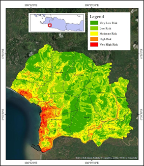
The Palabuhanratu Subdistrict, located in the Sukabumi Regency, is a high-risk area for tsunami disasters owing to tectonic activity along the Indo-Australian and Eurasian Plate subduction zones. The tsunami vulnerability level in this subdistrict is further heightened by the relatively dense population in its coastal areas, which increases the potential for loss of life and material losses. Therefore, an analysis of tsunami vulnerability levels and the planning of structural mitigation measures—such as shelters and evacuation routes—are crucial to protect communities from tsunami threats. This study aims to analyse the inundation area and affected population under tsunami scenarios with wave heights of 10, 15, and 20 m; identify the coverage of the proposed tsunami shelters; and evaluate the effectiveness of evacuation routes leading to the shelters in the Palabuhanratu Subdistrict. The methods employed include scoring and weighting techniques, Model Builder tools, and Network Analyst. The results indicate that coastal villages, such as Citepus, Jayanti, and Palabuhanratu, are highly vulnerable to tsunamis. Based on inundation modelling, Palabuhanratu Village had the largest inundated area and the highest number of affected residents. Most residents of Citepus and Jayanti Villages are located more than 1,350 m from the nearest shelter, with travel times exceeding 30 min. In contrast, the majority of residents in Palabuhanratu Village can reach shelters within 20 min, although some are still categorised as being in distant and very distant zones. A total of 11 evacuation routes were designed to connect the initial evacuation points to the shelters. However, 2 of the 11 routes, from Point 5 and 6, still exceed 1.000 m in distance and require more than 20 min of travel time.
Downloads
References
Ashar, F., Amaratunga, D. and Haigh, R., 2014. The analysis of tsunami vertical shelter in Padang City. Procedia Economics and Finance, 18, 916–923.
Faiqoh, I., Gaol, J.L. and Ling, M.M., 2013. Vulnerability level map of tsunami disaster in Pangandaran Beach, West Java. International Journal of Remote Sensing and Earth Sciences, 10, 90–103.
Gayer, G., Leschka, S., Nöhren, I., Larsen, O. and Gänther, H., 2010. Tsunami inundation modelling based on detailed roughness maps of densely populated areas. Natural Hazards and Earth System Sciences, 10, 1679–1687.
Ihsan, F. and Pramukanto, Q., 2017. Perencanaan lanskap Kota Pariaman Provinsi Sumatera Barat berbasis mitigasi tsunami. Jurnal Lanskap Indonesia, 9, 1–12.
Isagawa, T. and Ohno, R., 2018. Influence of residents’ cognition of their local environment on evacuation behavior from tsunamis: A case study of Onjuku, Chiba prefecture. Japan Architectural Review, 1, 486–503.
Ismiati, F., Damayanti, A. and Dimyati, M., 2020. Determining location of tsunami disaster temporary evacuation shelter (TES) utilizing network analysis in Makassar City, South Sulawesi Province. IOP Conference Series: Earth and Environmental Science, 500, 1–7.
Kanamori, H. and Brodsky, E.E., 2004. The physics of earthquakes. Reports on Progress in Physics, 67, 1429–1496.
Khalqillah, A., Muksin, U., Simanjuntak, A.V.H., Jihad, A. and Banyunegoro, V.H., 2022. Seismic hazard estimation for Sumatra and Kalimantan region using event-based probabilistic seismic hazard analysis (EB-PSHA). Journal of Geoscience, Engineering, Environment, and Technology, 10, 329–337.
Lovholt, F., Pedersen, G. and Glimsdal, S., 2010. Coupling of dispersive tsunami propagation and shallow-water coastal response. The Open Oceanography Journal, 4, 71–82.
Meilano, I. et al., 2020. Analisis potensi gempa di selatan Pulau Jawa berdasarkan pengamatan GPS. Jurnal Lingkungan dan Bencana Geologi, 11, 151–159.
Mildany, R. and Mirza, M., 2018. Shelter mitigasi bencana dengan penekanan arsitektur di Syiah Kuala Banda Aceh. Journal of Engineering Science, 4, 1–17.
Murjaya, J., 2023. Seismotektonik wilayah Indonesia Timur. Buletin Meteorologi, Klimatologi, dan Geofisika, 4, 14–22.
Nakai, H., Yoshioka, H. and Tsubaki, R., 2018. Tsunami evacuation simulation using GIS: A case study of welfare recipients in the 2011 Tohoku tsunami area. PLoS ONE, 13, 1–18.
Nugroho, F., Farhan, A.F. and Prasetiyo, N., 2024. Pembuatan story maps peta kerawanan tsunami dan rancangan jalur evakuasi di Pesisir Bantul. Jurnal Geodesi dan Geomatika, 7, 83–92.
Post, J. et al., 2009. Assessment of human immediate response capability related to tsunami threats in Indonesia at a sub-national scale. Natural Hazards and Earth System Sciences, 9, 1075–1086.
Puspitotanti, E. and Karmilah, M., 2022. Kajian kerentanan sosial terhadap bencana banjir. Jurnal Kajian Ruang, 1, 177–197.
Pothiawala, S. et al., 2016. Food and shelter standards in humanitarian action. Turkish Journal of Emergency Medicine, 15, 34–39.
Rosyadah, R., Sutoyo, Putra, H. and Ramadhanis, Z., 2025. Tsunami hazard level mapping and evaluation of temporary evacuation sites on the Palabuhanratu Coast. Jurnal Teknik Sipil dan Lingkungan, 10, 277–286.
Safitri, A.A. et al., 2018. Strain variation along the Cimandiri Fault, West Java, based on GPS observation from 2006–2016. IOP Conference Series: Earth and Environmental Science, 132, 1–5.
Sahputra, R., Sutikno, S. and Sandhyavitri, A., 2017. Mitigasi bencana kebakaran lahan gambut berdasarkan metode network analysis berbasis GIS. JOM FTEKNIK, 4, 1–11.
Sambah, A.B. and Miura, F., 2014. Integration of spatial analysis for tsunami inundation and impact assessment. Journal of Geographic Information System, 6, 11–22.
Saputra, I.D., Subardjo, P. and Handoyo, G., 2014. Peta kerawanan tsunami serta rancangan jalur evakuasi di Pantai Parangtritis. Jurnal Oseanografi, 3, 722–731.
Sihombing, S. et al., 2024. Tsunami modeling using DEMNAS and UAV surveys for evacuation route planning at Samas Coast, Bantul. Journal of Geoscience, Engineering, Environment, and Technology, 9, 152–157.
Stefanus, A., Hutapea, A.T.J. and Ibrahim, W., 2022. Penentuan jalur evakuasi dan shelter untuk kawasan pariwisata: Studi di Kecamatan Anyar. Jurnal Pelita Kota, 3, 279–297.
Subardjo, P., Saputro, S. and Aeda, S.A., 2017. Simulation of tsunami wave propagation and run-up at Pangandaran Bay. International Journal of Marine and Aquatic Resource Conservation and Co-existence, 2, 31–37.
Sudaryatno, S. 2024. Analysis and geovisualization of tsunami hazard and evacuation routes in the Opak–Progo coastal area. Forum Geografi, 38, 257–265.
Syafitri, Y., Bahtiar and Didik A., 2018. Analisis pergeseran lempeng bumi yang meningkatkan potensi gempa Lombok. Jurnal Fisika dan Pendidikan Fisika, 3, 139–146.
Sutikno, S. and Mukarami, K., 2015. Application of spatial and network analysis to evaluate shelter plan for tsunami evacuation. Civil Engineering Dimension, 17, 88–94.
Widiyantoro, S. et al., 2020. Implications for megathrust earthquakes and tsunamis from seismic gaps south of Java. Scientific Reports, 10, 1–11.
Ziadul, F. and Daidu, F., 2023. Study of coastal morphological changes by tsunamis in Aceh using satellite images. Journal of Geoscience, Engineering, Environment, and Technology, 8, 295–304.
Downloads
Published
Issue
Section
License
Copyright (c) 2025 Journal of Geoscience, Engineering, Environment, and Technology

This work is licensed under a Creative Commons Attribution-ShareAlike 4.0 International License.
Copyright @2019. This is an open-access article distributed under the terms of the Creative Commons Attribution-ShareAlike 4.0 International License which permits unrestricted use, distribution, and reproduction in any medium. Copyrights of all materials published in JGEET are freely available without charge to users or / institution. Users are allowed to read, download, copy, distribute, search, or link to full-text articles in this journal without asking by giving appropriate credit, provide a link to the license, and indicate if changes were made. All of the remix, transform, or build upon the material must distribute the contributions under the same license as the original.