
Correlation Between Land Cover Change and the Spatial Distribution of Land Surface Temperature in Tanjungpinang City, Indonesia
DOI:
https://doi.org/10.25299/jgeet.2026.11.1.22825Keywords:
Land Surface Temperature (LTS), Land Cover (LC)Abstract
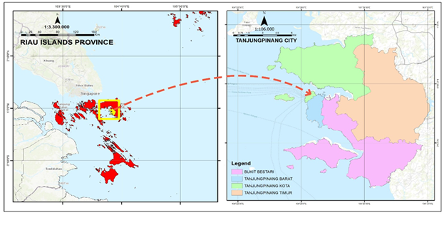
Land cover change is a global environmental issue driving the Urban Heat Island (UHI) effect, in which artificial surfaces experience higher temperatures than vegetated areas. Tanjungpinang City, the capital of the Riau Islands Province, has experienced rapid development driven by population growth, leading in the conversion of green spaces into settlements and infrastructure and increasing urban heat island (UHI) risks. This study analyzes changes in land cover and land surface temperature (LST) from 2003 to 2023 and examines their Correlation. Using Google Earth Engine (GEE), we processed Landsat and MODIS imagery and used correlation analysis to assess the relationship between land cover changes and land surface temperature (LST) dynamics. The results of the study indicate that during the 2003–2023 period, Built-up Land experienced a significant increase of 27.15 km², which inversely correlated with a reduction in Vegetation area by 14.02 km². This transformation triggered an expansion of areas categorized under high and very high land surface temperatures in Tanjungpinang City. Correlation and regression analyses confirm a strong negative relationship between Vegetation and LST, underscoring vegetation's crucial role in reducing heat through shading and evapotranspiration. Conversely, Built-up Land shows a strong positive correlation with LST, highlighting its contribution as a primary driver of surface heat. Meanwhile, Water Bodies and Bare Land exhibit more varied influences with relatively minor impacts on overall urban temperature fluctuations. In general, this research concludes that the conversion of vegetated land to Built-up Land is the main factor driving increases in surface temperatures in Tanjungpinang City. These findings are expected to serve as a strategic foundation for the local government in evaluating spatial planning policies and prioritizing the integration of Green Open Spaces to achieve sustainable urban planning that is adaptive to climate change.
Downloads
References
Adeyeri, O. E., Zhou, W., Ndehedehe, C. E., & Wang, X. (2024). Global vegetation, moisture, thermal, and climate interactions intensify compound extreme events. Science of the Total Environment, 912(December 2023), 169261.
Ahmad, M. N., Shao, Z., & Javed, A. (2023). Modelling land use/land cover (LULC) change dynamics, prospects, and their environmental impacts based on geospatial data models and remote sensing data. Environmental Science and Pollution Research, 30(12), 32985–33001.
Alexander, C. (2020). Normalised difference spectral indices and urban land cover as indicators of land surface temperature (LST). International Journal of Applied Earth Observation and Geoinformation, 86(November 2019), 102013.
Alfiansyah, M., Nuarsa, I. W., & Brasika, I. B. M. (2023). Perbandingan Beberapa Metode Klasifikasi Menggunakan Citra Landsat dan Sentinel Untuk Pemetaan Sebaran Mangrove Di Kawasan Ekowisata Mangrove PIK Jakarta Utara. Journal of Marine and Aquatic Sciences, 9(1), 82.
Alisjahbana, A. S., & Murniningtyas, E. (2018). TUJUAN PEMBANGUNAN BERKELANJUTAN DI INDONESIA: KONSEP, TARGET DAN STRATEGI IMPLEMENTASI. In Unpad Press.
Ally, H., Wahyuningtyas, J., & Rahmadana, M. I. (2024). Analisis Spatio temporal Pengaruh Aktivitas industri terhadap fenomena UHI dan LST di Kota Jakarta Timur. ENVIRO: Journal of Tropical Environmental Research, 26(1), 26.
Anasiru, R. H. (2016). Spatial Analysis in the Classification of Critical Land in The Sub-Basin of Langge Gorontalo. Jurnal Informatika Pertanian, 25(2), 261–272.
Bogaert, J., Vranken, I., & Andre, M. (2014). Biocultural Landscapes. Biocultural Landscapes.
BPS Tanjungpinang. (2023). Kota Tanjungpinang Dalam Angka 2024. In Badan Pusat Statistik. BPS Kota Tanjungpinang/BPS-Statistics Tanjungpinang Municipality.
Chatterjee, U., & Majumdar, S. (2022). Impact of land use change and rapid urbanization on urban heat island in Kolkata city: A remote sensing based perspective. Journal of Urban Management, 11(1), 59–71.
Cheval, S., Amihăesei, V. A., Chitu, Z., Dumitrescu, A., Falcescu, V., Irașoc, A., Micu, D. M., Mihulet, E., Ontel, I., Paraschiv, M. G., & Tudose, N. C. (2024). A systematic review of urban heat island and heat waves research (1991–2022). Climate Risk Management, 44(March).
Eboy, O. V., & Kemarau, R. A. (2023). Analysis of Extreme Heat Land Surface Temperature at a Tropical City (1988-2022): A Study on the Variability of Hot Spot during El Niño Southern Oscillation (ENSO). Science and Technology Indonesia, 8(3), 388–396.
Egorov, A. V., Hansen, M. C., Roy, D. P., Kommareddy, A., & Potapov, P. V. (2015). Image interpretation-guided supervised classification using nested segmentation. Remote Sensing of Environment, 165, 135–147.
Farnaz, Nuthammachot, N., & Ali, M. Z. (2025). Comparative study of multiple algorithms classification for land use and land cover change detection and its impact on local climate of Mardan District, Pakistan. Environmental Challenges, 18(December 2024), 101069.
Fathoni, M. A. (2025). Spatiotemporal analysis of land surface temperature and land cover change: Assessing the impact of urbanization and vegetation dynamics. Spatial Review for Sustainable Development, 2(1), 21–37.
Gomaa, M. M., Nabil, J., Berkouk, D., & Ragab, A. (2025). A Comparative Study of Vegetation Strategies for Outdoor Thermal Comfort in High- and Low-Density Urban Areas. Urban Science, 9(10), 1–30.
Guha, S., & Govil, H. (2020). Land surface temperature and normalized difference vegetation index relationship: a seasonal study on a tropical city. SN Applied Sciences, 2(10), 1–14.
Handayani, M. N., Sasmito, B., & Putra, A. (2017). ANALISIS HUBUNGAN ANTARA PERUBAHAN SUHU DENGAN INDEKS KAWASAN TERBANGUN MENGGUNAKAN CITRA LANDSAT (STUDI KASUS : KOTA SURAKARTA). Jurnal Geodesi Undip, 6(4), 517–525.
Hermosilla, T., Wulder, M. A., White, J. C., & Coops, N. C. (2022). Land cover classification in an era of big and open data: Optimizing localized implementation and training data selection to improve mapping outcomes. Remote Sensing of Environment, 268, 112780.
Irawandani, T. D., Dipareza, A., & Hermana, J. (2018). The effect of land cover change on surface temperature based on satellite imagery in 30 cities in Indonesia. EnvironmentAsia, 11(1), 100–111.
Jannah, G. S., & Bioresita, F. (2023). Pemantauan Land Surface Temperature (LST) dan Kaitannya dengan Tutupan Lahan (Studi Kasus: Kota Surabaya Tahun 2014-2022). Jurnal Teknik ITS, 12(2).
Kafy, A. Al, Dey, N. N., Al Rakib, A., Rahaman, Z. A., Nasher, N. M. R., & Bhatt, A. (2021). Modeling the relationship between land use/land cover and land surface temperature in Dhaka, Bangladesh using CA-ANN algorithm. Environmental Challenges, 4(June), 100190.
Kalamkar, S., & Geetha Mary, A. (2023). Multimodal image fusion: A systematic review. Decision Analytics Journal, 9(August), 100327.
Kausarian, H., Septio, G., Sumantyo, J. T. S., Tutuko, P., Suryadi, A., & Mairizki, F. (2023). Landslide Vulnerability Identification Based on the Geological Condition, GIS Calculation, and Field Validation in the Tropical Area. Evergreen, 10(4), 2423–2438.
Kurniantoro, R., Sasmito, B., & Hadi, F. (2023). Analisis Pengaruh Perubahan Kawasan Terbangun Menggunakan Algoritma Endisi Terhadap Suhu Permukaan Tanah. Jurnal Geodesi Undip, 12.
Livada, Č., Glavaš, H., Baumgartner, A., & Jukić, D. (2023). The Dangers of Analyzing Thermographic Radiometric Data as Images. Journal of Imaging, 9(7).
Lu, D., Mausel, P., Batistella, M., & Moran, E. (2003). Comparison of land-cover classification methods in the Brazilian Amazon basin. Photogrammetric Engineering and Remote Sensing, 70(6), 723–731.
Mohamed, A., Lorestani, N., & Shabani, F. (2025). Impact of urbanization on land surface temperature: A global perspective. Current Research in Environmental Sustainability, 10(October), 100315.
Moraes, D., Campagnolo, M. L., & Caetano, M. (2024). Training data in satellite image classification for land cover mapping: a review. European Journal of Remote Sensing, 57(1).
Noviani, R., Saputra, A. E., Wijayanti, P., & Koesoma, S. (2024). Analysis of Land Use Land Cover and Land Surface Temperature in Karst Area: A Case Study Wonogiri Regency. Indonesian Journal of Applied Physics, 14(1), 89.
Nurwanda, A., & Honjo, T. (2020). The prediction of city expansion and land surface temperature in Bogor City, Indonesia. Sustainable Cities and Society, 52, 101772.
Ouria, M., Almeida, A., Yaghoubi Kondelaji, S., Moura, P., & de Almeida, A. T. (2025). Sustainable urban mitigation strategies regarding heat-related mortalities and thermal discomfort: an overview and comparative analysis. In Theoretical and Applied Climatology (Vol. 156, Issue 6).
Rangel-Peraza, J. G., Sanhouse-García, A. J., Flores-González, L. M., Monjardín-Armenta, S. A., Mora-Félix, Z. D., Rentería-Guevara, S. A., & Bustos-Terrones, Y. A. (2024). Effect of land-use and land-cover changes on land-surface warming in an intensive agricultural region. Journal of Environmental Management, 371, 123249.
Rosandi, V. B., Pravitasari, A. E., & Rachendra, A. S. (2024). The Dynamics of Land Cover Change and Level of Sustainability Development in Depok City. Jurnal Pengembangan Kota, 12(1), 35–49.
Saputri, D. R., Afriadi, A., Hilmi, N., Chidmahdjati, A. B., & Apriyenson, H. (2025). Identifikasi Perkembangan Lahan Terbangun di Kota Tanjung Pinang Tahun 2004-2024. Jural Riset Rumpun Ilmu Teknik, 4(2), 481–490.
Seyam, M. M. H., Haque, M. R., & Rahman, M. M. (2023). Identifying the land use land cover (LULC) changes using remote sensing and GIS approach: A case study at Bhaluka in Mymensingh, Bangladesh. Case Studies in Chemical and Environmental Engineering, 7(November 2022), 100293.
Siregar, D. C., Ardah, V. P., & Ninggar, R. D. (2019). Identifikasi Kenyamanan Kota Tanjungpinang Berdasarkan Indeks Panas Humidex. Jurnal Ilmu Lingkungan, 17(2), 316.
Stamou, A., Dosiou, A., Bakousi, A., Karachaliou, E., Tavantzis, I., & Stylianidis, E. (2025). Assessing Spatial Correlations Between Land Cover Types and Land Surface Temperature Trends Using Vegetation Index Techniques in Google Earth Engine: A Case Study of Thessaloniki, Greece. Remote Sensing, 17(3).
Sudjana, L., Sodikin, & Astarika, R. (2024). Spatial analysis of mangrove cover change and land suitability for its rehabilitation in Tanjungpinang City, Riau Islands Province, Indonesia. AACL Bioflux, 17(6), 2905–2921.
Voogt, J. A., & Oke, T. R. (2003). Thermal remote sensing of urban climates. Remote Sensing of Environment, 86(3), 370–384.
Vujovic, S., Haddad, B., Karaky, H., Sebaibi, N., & Boutouil, M. (2021). Urban Heat Island: Causes, Consequences, and Mitigation Measures with Emphasis on Reflective and Permeable Pavements. CivilEng, 2(2), 459–484.
Wahyudi, A. J., Afdal, Prayudha, B., Dharmawan, I. W. E., Irawan, A., Abimanyu, H., Meirinawati, H., Surinati, D., Syukri, A. F., Yuliana, C. I., & Yuniati, P. I. (2018). Carbon sequestration index as a determinant for climate change mitigation: Case study of Bintan Island. IOP Conference Series: Earth and Environmental Science, 118(1).
Wang, J., Jiang, C., Yang, G., Bai, G., & Yu, S. (2023). Study on thermal health and its safety management mode for the working environment. Frontiers in Public Health, 11(August), 1–11.
Wang, S. W., Munkhnasan, L., & Lee, W. K. (2021). Land-use and land-cover change detection and prediction in Bhutan's high-altitude city of Thimphu using cellular automata and Markov chains. Environmental Challenges, 2(November 2020).
Wulder, M. A., Roy, D. P., Radeloff, V. C., Loveland, T. R., Anderson, M. C., Johnson, D. M., Healey, S., Zhu, Z., Scambos, T. A., Pahlevan, N., Hansen, M., Gorelick, N., Crawford, C. J., Masek, J. G., Hermosilla, T., White, J. C., Belward, A. S., Schaaf, C., Woodcock, C. E., … Cook, B.
D. (2022). Fifty years of Landsat science and impacts. Remote Sensing of Environment, 280(April), 113195.
Yoo, C., Im, J., Cho, D., Yokoya, N., Xia, J., & Bechtel, B. (2020). Estimation of all-weather 1 km MODIS land surface temperature for humid summer days. Remote Sensing, 12(9), 1–23.
Zhang, F., Zhang, X., Chen, W., Yang, B., Chen, Z., Tang, H., Wang, Z., Bi, P., Yang, L., Li, G., & Jia, Z. (2022). Cloud-Free Land Surface Temperature Reconstructions Based on MODIS Measurements and Numerical Simulations for Characterizing Surface Urban Heat Islands. IEEE Journal of Selected Topics in Applied Earth Observations and Remote Sensing, 15, 6882–6898. https://doi.org/10.1109/JSTARS.2022.3199248
Zhao, K., Jin, B., Fan, H., Song, W., Zhou, S., & Jiang, Y. (2019). High-performance overlay analysis of massive geographic polygons that considers shape complexity in a cloud environment. ISPRS International Journal of Geo-Information, 8(7).
Zhu, K., Cheng, Y., Zhou, Q., Kápolnai, Z., & Dávid, L. D. (2023). The contributions of climate and land-use/land-cover changes to water yield services across geographic scales. Heliyon, 9(10).
Downloads
Published
Issue
Section
License
Copyright (c) 2026 Journal of Geoscience, Engineering, Environment, and Technology

This work is licensed under a Creative Commons Attribution-ShareAlike 4.0 International License.
Copyright @2019. This is an open-access article distributed under the terms of the Creative Commons Attribution-ShareAlike 4.0 International License which permits unrestricted use, distribution, and reproduction in any medium. Copyrights of all materials published in JGEET are freely available without charge to users or / institution. Users are allowed to read, download, copy, distribute, search, or link to full-text articles in this journal without asking by giving appropriate credit, provide a link to the license, and indicate if changes were made. All of the remix, transform, or build upon the material must distribute the contributions under the same license as the original.


