Slope Stability Analysis Through the Application of Digital Imagery and Field Validation Using SMR and Q-Slope Methods: A Case Study of Bandar Lampung City, Indonesia
DOI:
https://doi.org/10.25299/jgeet.2026.11.1.20520Keywords:
Slope Stability, Geographic Information Systems, Slope Mass Rating, Q-Slope, Bandar Lampung CityAbstract
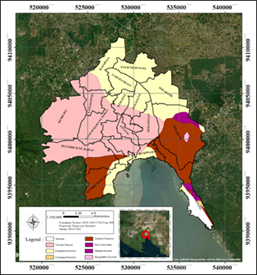
The investigation is on slope stability in cities such as Bandar Lampung by combining digital imagery from Geographic Information Systems (GIS) and field validation using Slope Mass Rating (SMR) and Q-Slope methods. The research study emphasizes the area of study, which is the city of Bandar Lampung, as the topography is highly diverse and the incidence of landslides is high. The Analytical Hierarchy Process (AHP) employed slope stability assessment by indicating vital parameters such as slope gradient, Normalized Difference Vegetation Index (NDVI), rock type and rainfall, and used AHP to produce a detailed slope stability map, classifying the areas surveyed into three degrees of hazards: low, medium and high.
Of these results, low hazard areas occupy an area of 101.56 km², medium hazard areas area covers 52.79 km², and high hazard areas occupy an area of 25.47 km². Field validation using SMR and Q-slope methods at vital sites revealed that most slopes fall into classes of stability, poor to very poor. The dominant types of landslides identified are planar and wedge failures. Based upon the Q-Slope Stability Chart recommended stable slope angles from a range of 42° to 61° were established for different sites.
This study shows that these areas are characterized by medium to high hazards, offering steep slopes that have little or almost no vegetational cover, thus greatly enhancing the possibilities of landslides taking place. A Well established correlation between GIS-based mapping and field observation proves how accurate the results would be in the integration of SMR and Q-Slope approaches that would give even better recommendations for slope stabilization measures or landslide mitigations. Findings of the research provide significant information for the matters of urban spatial planning and pro-active disaster risk management in landslide-prone regions of Bandar Lampung.
Downloads
References
Agustina, L.K., Harbowo, D.G., Farishi, B.A., 2020. Identifikasi Kawasan Rawan Longsor Berdasarkan Karakteristik Batuan Penyusun Di Kota Bandar Lampung. Elipsoida : Jurnal Geodesi dan Geomatika 3, 30–37.
Ahmad, M.S., MonaLisa, Khan, S., 2023. Comparative Analysis of Analytical Hierarchy Process (AHP) and Frequency Ratio (FR) Models for Landslide Susceptibility Mapping in Reshun, NW Pakistan. Kuwait Journal of Science 50, 387–398.
Aminudin, A., Wijaya, A.P., Hadi, F., 2023. Analisis Zona Rawan Tanah Longsor Menggunakan Metode Fuzzy Analytical Hierarchy Process (FAHP) (Studi Kasus: Kabupaten Boyolali). Jurnal Geodesi Undip 12, 231–240.
Azarafza, M., Kockar, M., Zhu, H.-H., 2022. Correlations of SMR-Qslope Data in Stability Classification of Discontinuous Rock Slope: A Modified Relationship Considering the Iranian Data. Geotechnical and Geological Engineering.
Azarafza, M., Nikoobakht, S., Rahnamarad, J., Asasi, F., Derakhshani, R., 2020. An empirical method for slope mass rating-Qslope correlation for Isfahan province, Iran. MethodsX 7, 101069.
Bar, N., Barton, N., 2017. The Q-slope method for rock slope engineering. Rock Mechanics and Rock Engineering 50, 3307–3322.
Bera, B., Saha, S., 2024. Estimation of road cut slope stability along the national and state highway of Garhwal Himalaya (India) applying slope mass rating and kinematic analysis. Results in Earth Sciences 2, 100026.
Bieniawski, Z.T., 1989. Engineering rock mass classifications: a complete manual for engineers and geologists in mining, civil, and petroleum engineering. John Wiley & Sons.
BNPB, 2024. Indeks Risiko Bencana Indonesia, Tahun 2023. Badan Nasional Penanggulangan Bencana 02.
Damares, T.O., Fadlan Irsyad Ramadhan, Leroy Otieno Kai, Chaka Diallo, 2024. Slope Stability Analysis Using the Rock Structure Rating (RSR) Method And Atterberg Limit at Riau - West Sumatra Cross road Km 165 Harau Subdistrict, Lima puluh Kota Regency, West Sumatra Province. J. Geoscience Eng. Environ. Technol. 9, 140–151.
Dhungana, G., Ghimire, R., Poudel, R., Kumal, S., 2023. Landslide susceptibility and risk analysis in Benighat Rural Municipality, Dhading, Nepal. Natural Hazards Research 3, 170–185.
Farazi, A.H., Mia, A.J., Mahmud, Md.I., 2018. A Case Study Based Slope Stability Analysis at Chittagong City, Bangladesh. J. Geoscience Eng. Environ. Technol. 3, 164.
Fareka, M.A., Sutarto, N.R., Pamungkas, T.D., 2020. Analisis Stabilitas Lereng Pada Pelapukan Batuan Vulkanik Dicikalongwetan Kabupaten Bandung Barat. Jurnal Geografi Gea 20, 26–38.
Hardianto, A., Winardi, D., Rusdiana, D.D., Putri, A.C.E., Ananda, F., Devitasari, Djarwoatmodjo, F.S., Yustika, F., Gustav, F., 2020. Pemanfaatan Informasi Spasial Berbasis SIG untuk Pemetaan Tingkat Kerawanan Longsor di Kabupaten Bandung Barat, Jawa Barat. J. Geosains Remote Sens. 1, 23–31.
Hoek, E., Bray, J.D., 1981. Rock slope engineering. CRC press.
Idris, M.V., Muksin, U., Syukri, M., 2024. The Influence of Slope, Rock Characteristics and Meteorological Data to Landslide: A Case Study in The Northernmost Sumatra, Indonesia. J. Geoscience Eng. Environ. Technol. 9, 511–518.
Januar, D., Suprayogi, A., Prasetyo, Y., 2016. Analisis Penggunaan NDVI dan BSI Untuk Identifikasi Tutupan Lahan Pada Citra Landsat 8 (Studi Kasus: Wilayah Kota Semarang, Jawa Tengah). Jurnal Geodesi Undip 5, 135–144.
Jorda-Bordehore, L., Bar, N., González, M.C., Guill, A.R., Jover, R., 2018. Stability assessment of rock slopes using empirical approaches: comparison between slope mass rating and Q-slope. Presented at the Proceedings of XIV Congreso Internacional de Energía y Recursos Minerales and Slope Stability, pp. 10–13.
Kinde, M., Getahun, E., Jothimani, M., 2024. Geotechnical and slope stability analysis in the landslide-prone area: A case study in Sawla – Laska road sector, Southern Ethiopia. Scientific African 23, e02071.
Kouhdaragh, M., Azarafza, M., Derakhshani, R., 2022. A Qslope-based empirical method to stability assessment of mountain rock slopes in multiple faults zone: A case for North of Tabriz. MethodsX 9, 101718.
Kurniawan, R., 2019. Determination of landslide susceptibility level using scoring method in Pugung Area, Tanggamus. IOP Conf. Ser.: Mater. Sci. Eng. 620, 012126.
Machay, F., El Moussaoui, S., El Talibi, H., 2023. Insights into large landslide mechanisms in tectonically active Agadir, Morocco: The significance of lithological, geomorphological, and soil characteristics. Scientific African 22, e01901.
Mangga, S.A., Gafoer, S., Pardede, G.S., 1993. Peta Geologi Lembar Tanjungkarang, Sumatera. Pusat Penelitian dan Pengembangan Geologi.
Patil, A.S., Panhalkar, S.S., 2023. Remote sensing and GIS-based landslide susceptibility mapping using LNRF method in part of Western Ghats of India. Quaternary Science Advances 11, 100095.
Pradhan, B., Dikshit, A., Lee, S., Kim, H., 2023. An explainable AI (XAI) model for landslide susceptibility modeling. Applied Soft Computing 142, 110324.
Putra, D.B.E., Choanji, T., 2016. Preliminary Analysis of Slope Stability in Kuok and Surrounding Areas. J. Geoscience Eng. Environ. Technol. 1, 41.
Radityo, D., Bilal Al Farishi, Rezky Naufan Hendrawan, Alviyanda, Imam Ahmad Sadisun, 2024. Slope Stability Analysis Throughout Road Around Bukit Barisan Selatan National Park (BBSNP) using Fellenius Method. J. Geoscience Eng. Environ. Technol. 9, 279–286.
Reichenbach, P., Rossi, M., Malamud, B.D., Mihir, M., Guzzetti, F., 2018. A review of statistically-based landslide susceptibility models. Earth-Science Reviews 180, 60–91.
Romana, M., Tomás, R., Seron, J.B., 2015. Slope Mass Rating (SMR) geomechanics classification: thirty years review. Presented at the ISRM Congress, ISRM, p. ISRM-13CONGRESS.
Wibowo, R., Rizkiano, A., Sarkowi, M., 2022. Identifikasi Zona Potensi Longsor Menggunakan Metode Fotogrametri Foto Udara Area Pidada Kota Bandar Lampung. Jurnal Geosains dan Remote Sensing 3, 70–76.
Xu, Q., Zhao, B., Dai, K., Dong, X., Li, W., Zhu, X., Yang, Y., Xiao, X., Wang, X., Huang, J., Lu, H., Deng, B., Ge, D., 2023. Remote sensing for landslide investigations: A progress report from China. Engineering Geology 321, 107156.
Downloads
Published
Issue
Section
License
Copyright (c) 2026 Journal of Geoscience, Engineering, Environment, and Technology

This work is licensed under a Creative Commons Attribution-ShareAlike 4.0 International License.
Copyright @2019. This is an open-access article distributed under the terms of the Creative Commons Attribution-ShareAlike 4.0 International License which permits unrestricted use, distribution, and reproduction in any medium. Copyrights of all materials published in JGEET are freely available without charge to users or / institution. Users are allowed to read, download, copy, distribute, search, or link to full-text articles in this journal without asking by giving appropriate credit, provide a link to the license, and indicate if changes were made. All of the remix, transform, or build upon the material must distribute the contributions under the same license as the original.