Stream Morphometry as Response to the Level of Tectonic Deformation on Sorowako and Surrounding Areas, Indonesia
DOI:
https://doi.org/10.25299/jgeet.2025.10.3.17977Keywords:
Morphometry, Tectonic, Deformation, Water Catchment Area, SorowakoAbstract
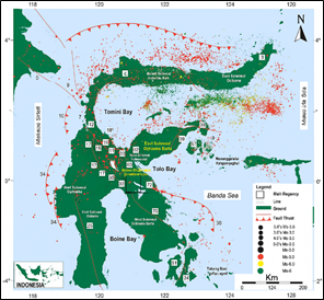
Sorowako and surrounding areas are geologically influenced by Sulawesi’s microcontinent movement, which has produced several geological phenomena. Morphometry is one of the parameter that can reveal geological condition of particular area. Morphometric analysis of water catchment area in Sorowako and surrounding areas using Bifurcation Ratio (Rb) and Drainage Density (Dd) can provide comprehensive information on level of deformation in Sorowako region. Analysis result of Bifurcation Ratio Index (Rb) on water catchment area reveals that Rb<3 value is dominant and equally spread in Sorowako region, it varies from 0.094 to 2.888. However in several place the value of Bifurcation Ratio (Rb) index is more than 5 (Rb>5) with varies from 5.142 to 10.250. Drainage Density (Dd) value ranges from 0.907 to 8.422 with an average value is 4.125 describes impact of erosion and tectonic on Sorowako region. Based on morphometric analysis of two parameters, Sorowako and surroundings area have been heavily impacted by tectonic activity on Sulawesi island. In western, eastern and northern regions on water catchment area, level of deformation tends to be higher compared to southern region. This can be seen on analysis result of water catchment area 43, water catchment area 196, and water catchment area 302 that have relatively larger number of stream orders, and also have Bifurcation Ratio’s value less than three (Rb<3). Information of tectonic deformation level on Sorowako region through morphometric analysis is important to further use as a basis for water catchment area management planning, so that it can identify areas prone to geological disasters. This fairly high level of tectonic deformation also believed to be a controlling factor for nickel grade contained in Sorowako and surrounding areas which allow supergene enrichment to occurs in rocks.
Downloads
References
Almira, K., Sukiyah, E., Rendra, P.P.R., 2025. Karakteristik Pengaruh Tektonik Relatif pada Daerah Aliran Sungai Cikandang Bagian Tenggara. Padjadjaran Geoscience Journal, Vol.9 No.1.
Arulbalaji, P., Padmalal, D., 2020. Sub-watershed Prioritization Based on Drainage Morphometric Analysis: A Case Study of Cauvery River Basin in South India. Jour. Geol. Soc. India, v.95(1), pp.25–35.
Assalwa,H., Pasaribu, J.E., Refaldy, R., 2025. Analisis Geomorfologi Pulau Sulawesi: Kajian Terpadu Struktur Geologi Dan Dinamika Tektonik Review Literatur 2015-2024. Jurnal Pendidikan Sosial dan Humaniora, Vol. 4, No. 2.
Barman, B.K., Bawri, G.R., Rao, K.S., Singh, S.K., Patel, D., 2021. Drainage network analysis to understand the morphotectonic significance in upper Tuirial watershed, Aizawl, Mizoram. In: Agricultural Water Management, Academic Press, pp.349–373.
Bellier, O., Sébrier, M., Seward, D., Beaudouin, T., Villeneuve, M., and Putranto, E., 2006. Fission track and fault kinematics analyses for new insight into the Late Cenozoic tectonic regime changes in West-Central Sulawesi Indonesia. Tectonophysics, 413(3–4), 201– 220.
Erawan, E., Sukiyah, E., Hutabarat, J., Sudrajat, A., 2020. The Permeability of Granite Weathering Soil in Tanjungpinang Bintan Island Indonesia. Journal of Geoscience Engineering Environment and Technology. Vol 05 No 03.
Golightly, P.J., 1979. Nikeliferous Laterite: A General Description. International Laterite Symposium. Canada: Inco Metals Company.
Gupta, K.L., Kumar, N., Bisht, K.S., 2019. Morphometric Analysis Using Geospatial Technology: A Case Study of Bidoli Gad Basin Uttrakhand. The Research Journal of Social Sciences Vol.10 No.7.
Hasria., Sidik, M., Awadh, S.M., Masri., Okto, A., Azzaman, M.A., Muliddin., Hamimu, L., Sallihin, L.O.M.I., Sawaludin., 2023. Orogenic Gold Deposit in Metamorphic Rocks: Minerals and Structural Control at Rarowatu Area, Southeastern Arm of Sulawesi, Indonesia. Iraqi Geological Journal.
Horton, R.E., 1945. Erosional Development of Streams and Their Drainage Basins; Hydrophysical Approach to Quantitative Morphology. Geological Society of America Bulletin, 56, 275-370.
Javed, A., Khanday, M.Y., Ahmed, R., 2009. Priorization of Sub-watersheds Based on Mophometric and Land Use Analysis Using Remote Sensing and GIS Techniques. Journal Indian Soc. Remote Sensing 37: 261-274.
Khalifa, A., Bashir, B., Alsalman, A., Ögretmen, N., 2021. Morphotectonic Assessment Of The Abu Dabbab Area, Eastern Desert, Egypt: Insights From Remote Sensing and Geospasial Analysis. International Journal of Geoinformation.
Pachri, H., Azikin, B., Alimuddin, I., 2024. The Role of Geological Information’s in The Development of Geopark Area in South Sulawesi, Indonesia. IOP Conf. Series: Earth and Environmental Science 1424.
Putri, A. N., Setiawan, B., 2023. Analisis tektonik relatif menggunakan metode morfotektonik daerah Lintau Buo dan sekitarnya, Tanah datar, Sumatera Barat. Journal of Applied Geoscience and Engineering, 2(1), 1-10. V.A., 2014. Drainage Basin Analysis for Characterization of 3rd order watersheds Using Geographic Information System (GIS) and Aster Data. Journal of Geomatics, Vol 8 No.2.
Rendra, P.P.R., Sukiyah, E., Hadian, M.S.D., Daliman, S.B., Sulaksana, N., 2024. Quantitative Assessment of Relative Tectonic Activity in the Eastern Bandung Basin Indonesia. Geology, Ecology and Landscapes.
Rendra, P.P.R., Sukiyah, E., Hadian, M.S.D., Daliman, S.B., Sulaksana, N., 2023. The Quantitative Geomorphology of Upper Citarik Watershed and It’s Implication to The Flash Flood Potential. BIO Web of Conferences 73, 04010.
Rendra, P.P.R., Sukiyah, E., Hadian, M.S.D., Daliman, S.B., Sulaksana, N., 2023. Quantitative Geomorphology of Cipancar Watershed and The Implication for Flood Risk. International Journal of Geomate, Vol.25, Issue 111, PP 16-23.
Roselindyah, A.F., Sulaksana, N., Helmi, F., 2022. Morfometri Daerah Aliran Sungai Citarik Hulu Kaitannya dengan Penggunaan Lahan, Kecaman Cicalengka dan Sekitarnya, Kabupaten Bandung. Padjadjaran Geosciensce Jurnal i-ISSN:2597-4033.
Siahaan, M.R.P., Sukiyah, E., Sulaksana, N., Haryanto, A.D. 2023. The Impact of Digital Elevation Models on Tectonic Activity Assessment Based on Morphotectonics Indices: A Case of Seulawah Agam Volcano Indonesia. Journal of Degraded and Mining Lands Management. Vol.10 No.3.
Siahaan, M.R.P., Sukiyah, E., Sulaksana, N., Haryanto, A.D. 2022. Assessment of Active Tectonic from Morphometric Properties in Krueng Raya Watershed Aceh Besar Indonesia. Engineering Letters, 30:3.
Simandjuntak, T.O., Rusmana, E., Surono., Supandjono, J.B., 1991. Geology of The Malili Quadrangle, Sulawesi. Bandung: Directorates of General Geology and Mineral Resources, Department of Mines and Energy.
Soehaimi, A., Padmawidjaja, T., Subagio., Mandi, I., Tohari, A., Suharsono., Menier, D., Mathew, M., Ramkumar, M., Novico, F. 2025. Assessing Geological and Seismic Hazards of Malili-Matano Region, East Luwu Regency, Sulawesi: A preliminary study for CCS and Strategic Infrastructure Planning. Environmental Challenges 19, 101177.
Strahler, A.N., 1964. Quantitative Geomorphology of Drainage Basins and Channel Networks. In Chow, V.T. (ed.). Handbook of Applied Hydrology, McGraw-Hill, New York. Pp 439-476.
Sukiyah, E., 2017. Sistem Informasi Geografis Konsep dan aplikasinya dalam analisis geomorfologi kuantitatif (1st ed.). Unpad Press.
Sukiyah, E., Jassin, A.M.I., Arfiansyah, K., 2021. The Impact Of Erosion-Sedimentations To Siltation Of Kendari Bay and Implication In Tourism Development Of Southeast Sulawesi Indonesia. Journal of Geological Science and Applied Geology, Vol.4 No.2.
Sukiyah, E., Mawardi, S., Rendra, P.P.R., Tresnasari, E., Nurfadli,E., Setiawan, H., 2022. The Active Fault Detection Base On Morphotectonic Characteristic Of Cikeruh Watershed West Java Indonesia. Journal of Engineering Science and Technology.
Verstappen, H., 1983. Apllied Geomorphology: Geomorphological Surveys for Environment Development. New York: Elsevier Science Pub. Co. Inc. 437p.
Villeneuve, M., Gunawan, W., Cornee, J.J., Vidal, O., 2002. Geology of the central Sulawesi belt (eastern Indonesia): constraints for geodynamic models, International Journal of Earth Sciences, 91(3), 524–537.
Winarti, Sukiyah, E., Syafri, I., Nur, A.A., 2022. Tectonic Control of The Nanggulan Formation Based On Morphometric Analysis In Kulon Progo Indonesia. Indonesian Journal On Geoscience, Vol.9 No.2, 147-157. Regulation of Minister of Public Works and Public Housing No.4 /PRT/M/2015. Criteria for Determining River Basins.
Togao, P., Asrafil., Abdulah, A.I., 2025. Subsurface Identification of the Continuation of the Palu-Koro Fault Zone in the Palu Segment Using the Electrical Resistivity Method in the Area from Rogo to Bulubete, Sigi, Central Sulawesi. IOP Conf. Series: Earth and Environmental Science 1517.
Downloads
Published
Issue
Section
License
Copyright (c) 2025 Journal of Geoscience, Engineering, Environment, and Technology

This work is licensed under a Creative Commons Attribution-ShareAlike 4.0 International License.
Copyright @2019. This is an open-access article distributed under the terms of the Creative Commons Attribution-ShareAlike 4.0 International License which permits unrestricted use, distribution, and reproduction in any medium. Copyrights of all materials published in JGEET are freely available without charge to users or / institution. Users are allowed to read, download, copy, distribute, search, or link to full-text articles in this journal without asking by giving appropriate credit, provide a link to the license, and indicate if changes were made. All of the remix, transform, or build upon the material must distribute the contributions under the same license as the original.