
Drought Management in Batam using Combined NDVI-TCT Algorithm to Create a Classification Level Map
DOI:
https://doi.org/10.25299/jgeet.2024.9.3.13033Keywords:
Urban Drought, Spatial Distribution, NDVI-TCT Algorithm, Spatial AssessmentAbstract
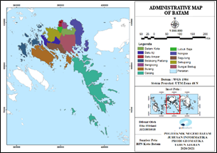
Drought constitutes a significant natural disaster with profound implications for agricultural productivity, economic stability, and ecological balance. Batam is one of the cities experiencing a high level of drought. At the end of 2022, Batam is actually on the verge of drought. The purpose of this study is to find out information on the distribution of potential for drought in Batam and the dominant factors affecting the potential for drought occurred using NDVI and TCT algorithms. This research employed remote sensing and GIS techniques, using Landsat 8 images to acquire parameters from NDVI, TCT, and Rainfall data, which are then processed through scoring and overlaying. The final step was to validate the vegetation index parameter by taking the coordinates. The final result is a map of the potential for drought in Batam, consisting of 5 classes of potential for drought. The area with a very low potential for drought was located mostly in Sagulung, with an area of 2.661,89 Ha. The areas with low potential for drought were mostly located in Nongsa, Batam Center, Batu Ampar, Bengkong, Lubuk Baja, and Batu Aji, with an area of 7.175,22 Ha. The areas with a very high potential for drought were mostly located in Galang, Bulang, and Belakang Padang, with an area of 19.744,76 Ha. The area with moderate potential for drought was mostly located in Sungai Beduk, with an area of 22.122,71 Ha. The areas with high potential for drought were mostly located in Galang and Bulang, with an area of 35.663,89 Ha. It is concluded from the results of this research that the collective classification of high and very high drought potential levels covers up to 64% of the entire research area.
Downloads
References
Badan Pusat Statistik Kota Batam. Kota Batam Dalam Angka 2022. Batam: Badan Pusat Statistik Kota Batam
Shahpari, G., Sadeghi, H., Ashena, M., & García-León, D. (2022). Drought effects on the Iranian economy: a computable general equilibrium approach. Environment, Development and Sustainability, 24(3), 4110-412.
Zamroni, A., Kurniati, A. C., & Prasetya, H. N. E. (2020). The assessment of landslides disaster mitigation in Java Island, Indonesia: a review. Journal of Geoscience, Engineering, Environment, and Technology, 5(3), 124-128.
Kuswandi, Y., Erwindi, J., Hadian, M. S. D., & Muslim, D. (2020). Disaster Mitigation for Palu City Residents in Dealing with Liquefaction Disasters in Accordance of Spatial Patterns of Palu City, Central Sulawesi Province, Indonesia. Journal of Geoscience, Engineering, Environment, and Technology, 5(4), 191-197.
Ilham, A. P. (2023). The Effect of Natural Disaster on Regional Economic Growth, Unemployment, Poverty, and Human Development Index in Thirty Indonesian Provinces. Journal of Indonesian Applied Economics, 11(1), 40-59.
Amin, M., Prajati, G., Humairoh, G. P., Putri, R. M., Phairuang, W., Hata, M., & Furuuchi, M. (2023). Characterization of size-fractionated carbonaceous particles in the small to nano-size range in Batam city, Indonesia. Heliyon, 9(5).
Kattimani, J. M., & Renuka Prasad, T. J. (2015). Normalized Difference Vegetation Index (NDVI) Applications in part of South-Eastern Dry Agro-climatic Zones of Karnataka Using Remote Sensing and GIS. International Journal of Advanced Research, 3(12), 1593-1596.
Huang, S., Tang, L., Hupy, J. P., Wang, Y., & Shao, G. (2021). A commentary review on the use of normalized difference vegetation index (NDVI) in the era of popular remote sensing. Journal of Forestry Research, 32(1), 1-6.
Zhai, Y., Roy, D. P., Martins, V. S., Zhang, H. K., Yan, L., & Li, Z. (2022). Conterminous United States Landsat-8 top of atmosphere and surface reflectance tasseled cap transformation coefficients. Remote Sensing of Environment, 274, 112992.
Arunachalam, M., Joshua, R. M., Kochuparampil, A. J., & Saravanavel, J. (2023). ArcOLITIRS: A Toolbox for Radiometric Calibration and Surface Temperature Estimation from Landsat 8 Products in ArcGIS Environment. Journal of the Indian Society of Remote Sensing, 51(3), 453-468.
Teng, S., Liu, C., Tan, Z., Li, J., Xu, N., Hu, X., ... & Sohn, B. J. (2023). A multispectral method for retrieving overlapping cloud top heights from passive radiometers. Remote Sensing of Environment, 286, 113425.
de la Iglesia Martinez, A., & Labib, S. M. (2023). Demystifying normalized difference vegetation index (NDVI) for greenness exposure assessments and policy interventions in urban greening. Environmental Research, 220, 115155.
Deng, J., Dong, W., Guo, Y., Chen, X., Zhou, R., & Liu, W. (2023). A Novel Remote Sensing Image Enhancement Method, the Pseudo-Tasseled Cap Transformation: Taking Buildings and Roads in GF-2 as An Example. Applied Sciences, 13(11), 6585.
Rhymee, H., Ratnayake, U., Abdul Rahman, E. K., & Shams, S. (2023, January). Application of normalized difference vegetation index in agriculture to estimate rice yield. In AIP Conference Proceedings (Vol. 2643, No. 1, p. 030022). AIP Publishing LLC.
Mousania, Y., Karimi, S., & Farmani, A. (2023). Optical remote sensing, brightness preserving and contrast enhancement of medical images using histogram equalization with minimum cross-entropy-Otsu algorithm. Optical and Quantum Electronics, 55(2), 1-22.
Yang, P., Xia, J., Chen, Y., Zhang, Y., Li, Z., Zhang, S., & Wang, W. (2023). Dynamic evolution of recent droughts in Central Asia based on microwave remote sensing satellite products. Journal of Hydrology, 620, 129497.
Zhu, S., Wei, J., Zhang, H., Xu, Y., & Qin, H. (2023). Spatiotemporal deep learning rainfall-runoff forecasting combined with remote sensing precipitation products in large scale basins. Journal of Hydrology, 616, 128727.
NS, R. (2022). Drought Assessment Using Remote Sensing and Geographic Information Systems (GIS) Techniques (Case Study: Klaten Regency, Indonesia). International Journal of Geoinformatics, 18(5).
Mukherjee, I., & Singh, U. K. (2020). Delineation of groundwater potential zones in a drought-prone semi-arid region of east India using GIS and analytical hierarchical process techniques. Catena, 194, 104681.
Ponnusamy, D., & Elumalai, V. (2022). Determination of potential recharge zones and its validation against groundwater quality parameters through the application of GIS and remote sensing techniques in uMhlathuze catchment, KwaZulu-Natal, South Africa. Chemosphere, 307, 136121.
Dev Roy, S., & Trivedi, S. (2023). Geospatial Assessment of Long-Term Changes (1937–2019) in Mangrove Vegetation and Shoreline Dynamics of Godavari Estuary, East Coast of India. Journal of the Indian Society of Remote Sensing, 1-19.
Pandey, P. C., Anand, A., & Srivastava, P. K. (2019). Spatial distribution of mangrove forest species and biomass assessment using field inventory and earth observation hyperspectral data. Biodiversity and Conservation, 28, 2143-2162.
Downloads
Published
Issue
Section
License
Copyright (c) 2024 Journal of Geoscience, Engineering, Environment, and Technology

This work is licensed under a Creative Commons Attribution-ShareAlike 4.0 International License.
Copyright @2019. This is an open-access article distributed under the terms of the Creative Commons Attribution-ShareAlike 4.0 International License which permits unrestricted use, distribution, and reproduction in any medium. Copyrights of all materials published in JGEET are freely available without charge to users or / institution. Users are allowed to read, download, copy, distribute, search, or link to full-text articles in this journal without asking by giving appropriate credit, provide a link to the license, and indicate if changes were made. All of the remix, transform, or build upon the material must distribute the contributions under the same license as the original.


