
Impact of Land Use Change on Land Capability in Katingan Regency, Central Kalimantan, Indonesia
DOI:
https://doi.org/10.25299/jgeet.2023.8.3.12423Keywords:
Land use change, Land capability, Katingan RegencyAbstract
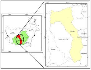
The imbalance between land use and land capability can cause environmental problems in Katingan Regency. This study aims to analyze changes in land use change for the 2015-2021 period, land capability, land cover suitability with land capability in Katingan Regency. This research uses the method of overlaying the 2015 and 2021 land cover maps, analyzing land capability with variables of erosion maps, flood maps, and aridity maps, and analyzing land suitability by overlapping land use maps and land capability maps. The results show that land use change is 67.864 ha with map accuracy KA = 90.6% and OA 81.1%, while the concentration of land use change in Malan Island District with an LQ value of 2.5. Land capability is divided into three with the limiting factors of erosion, flooding, and slope class, namely: class II, III, IV, VI, and VII which are designated as productive paddy fields, dry land agriculture, and agriculture mixed with shrubs. Land use change has an impact on land capability, namely the increase of unsuitable land by 23.050 ha. This research can provide important information for taking policies and strategies for optimizing land use at the site level in Katingan Regency in the future.
Downloads
References
Arsyad, S. (2005) Soil and Water Conservation. 2nd edn. Bogor, Indonesia: Pustaka IPB Press.
BNPB (2021) Data dan Informasi Kebencanaan Bulanan Teraktual. Jakarta.
BNPB (2022) ‘Banjir Ganggu Aktivitas Warga Kabupaten Katingan’, bnpb.go.id.
BPS (2016) Kabupaten Katingan dalam Angka 2016. Katingan: Banda Pusat Statistik.
BPS (2022) Kabupaten Katingan dalam Angka 2022. Katingan: Badan Pusat Statistik.
Brown, I. et al. (2009) ‘Land capability: A strategic planning tool for integrated climate change responses’, Iop Conference Series: Earth and Environmental Science, 6.
Dorais, A. and Cardille, J. (2011) ‘Strategies for Incorporating High-Resolution Google Earth Databases to Guide and Validate Classifications: Understanding Deforestation in Borneo’, Remote Sensing, 3, pp. 1157–1176.
Ekadinata, A. et al. (2011) Indonesia’s land-use and land-cover changes and their trajectories (1990, 2000 and 2005)(ALLREDDI Brief 01), Bogor: World Agroforestry Centre–ICRAF, SEA Regional Office.
Fang, H. (2021) ‘Effect of soil conservation measures and slope on runoff, soil, TN, and TP losses from cultivated lands in northern China’, Ecological Indicators, 126, p. 107677.
Fitriah, D. (2011) ‘Perubahan penggunaan lahan dan pengaruhnya terhadap daya dukung lahan untuk mendukung perencanaan penataan ruang (Studi kasus di kota Bima provinsi Nusa Tenggara Barat)’, in.
Foody, G.M. (2002) ‘Status of land cover classification accuracy assessment’, Remote Sensing of Environment, 80(1), pp. 185–201.
Gaveau, D.L.A. et al. (2014) ‘Four decades of forest persistence, clearance and logging on Borneo’, PloS one, 9(7), p. e101654.
Gaveau, D.L.A. et al. (2016) ‘Rapid conversions and avoided deforestation: examining four decades of industrial plantation expansion in Borneo’, Scientific reports, 6(1), pp. 1–13.
Hardjowigeno, S. and Widiatmaka (2007) ‘Suitability Evalution and Land Use Planning’. Yogaykarta, Indonesia: Gajah Mada University Press.
Lambin, E.F. et al. (2001) ‘The causes of land-use and land-cover change: moving beyond the myths’, Global Environmental Change, 11(4), pp. 261–269.
Maetens, W., Poesen, J. and Vanmaercke, M. (2012) ‘How effective are soil conservation techniques in reducing plot runoff and soil loss in Europe and the Mediterranean?’, Earth-Science Reviews, 115(1), pp. 21–36.
Maitima, J. et al. (2010) ‘Land use changes, impacts and options for sustaining productivity and livelihoods in the basin of lake Victoria’.
Margono, B.A. et al. (2014) ‘Primary forest cover loss in Indonesia over 2000–2012’, Nature climate change, 4(8), pp. 730–735.
Mujiyo, M., Sutarno, S. and Rafirman, R. (2018) ‘The impact of land use change on land capability in Tirtomoyo-Wonogiri’, Journal of Degraded and Mining Lands Management, 6(1), p. 1449.
Niin (2010) ‘Dinamika Spasial Penggunaan Lahan di Kabupaten Katingan dan Kota Palangaka Raya Provinsi Kalimatan Tengah’.
Nikkami, D., Elektorowicz, M. and Mehuys, G.R. (2002) ‘Optimizing the management of soil erosion’, Water Quality Research Journal, 37(3), pp. 577–586.
Pugara, A., Pradana, B. and Puspasari, D.A. (2021) ‘The Impact of The Land-Use Changes on The Water Carrying Capacity in Kajen, Indonesia: A Spatial Analysis’, {IOP} Conference Series: Earth and Environmental Science, 887(1), p. 12018.
Purwanto, J., Rusolono, T. and Prasetyo, L. (2015) ‘Spatial Model of Deforestation in Kalimantan from 2000 to 2013’, JMHT, 21, pp. 110–118.
Roy, P. and Roy, A. (2010) ‘Land Use and Land Cover Change: A Remote Sensing & GIS Perspective’, Journal of the Indian Institute of Science, 90, pp. 489–502.
Rusdiyatmoko, A. (2012) ‘Analysis of Flood Susceptibility Based on Raster Operation Method by Using Geographic Information System’.
Scriven, S.A. et al. (2015) ‘Protected areas in Borneo may fail to conserve tropical forest biodiversity under climate change’, Biological Conservation, 184, pp. 414–423.
Setyowati, D.L. et al. (2021) ‘Assessment of Watershed Carrying Capacity and Land Use Change on Flood Vulnerability Areas in Semarang City’, in Forum Geografi.
Vijith, H., Hurmain, A. and Dodge-Wan, D. (2018) ‘Impacts of land use changes and land cover alteration on soil erosion rates and vulnerability of tropical mountain ranges in Borneo’, Remote Sensing Applications: Society and Environment, 12, pp. 57–69.
Wells, J.A. et al. (2016) ‘Rising floodwaters: mapping impacts and perceptions of flooding in Indonesian Borneo’, Environmental Research Letters, 11(6), p. 64016.
Wheeler, J.O. (2005) ‘Geography’, in K.B.T.-E. of S.M. Kempf-Leonard (ed.). New York: Elsevier, pp. 115–123.
Wijitkosum, S. (2016) ‘The impact of land use and spatial changes on desertification risk in degraded areas in Thailand’, Sustainable Environment Research, 26(2), pp. 84–92.
Downloads
Published
Issue
Section
License
Copyright @2019. This is an open-access article distributed under the terms of the Creative Commons Attribution-ShareAlike 4.0 International License which permits unrestricted use, distribution, and reproduction in any medium. Copyrights of all materials published in JGEET are freely available without charge to users or / institution. Users are allowed to read, download, copy, distribute, search, or link to full-text articles in this journal without asking by giving appropriate credit, provide a link to the license, and indicate if changes were made. All of the remix, transform, or build upon the material must distribute the contributions under the same license as the original.


